Search

Search Results

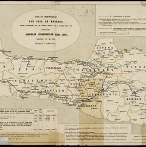
Kaart van het gebied bezet in Groot-Atjeh

event1895

location_onIndonesia

A large-scale map of Aceh, north Sumatra, spread over four sheets with details such as routes (rivers, roads, railways), crops (rice, banana, pepper, sugarcane, bamboo), land features (mountains, forests, wetlands) and settlements (cities, villages).

Java: Residentie Besoeki

event1895

location_onIndonesia

There are over 100 sheets of this very large-scale (1:20,000) topographic map of the regency of Besoeki, Java. Cities and villages, roads, railways and rivers, crops and many more features are all shown in great detail.

Kaart aantoonende districtsgewijs den aard van het grondbezit op Java en Madoera

event1895

location_onIndonesia

This map shows Java and Madura divided into regencies which are then subdivided into districts. Each district is coloured to represent land ownership (‘Communaal bezit [Communal property]’) as recorded in 1895.

Kaart van het Westelijk gedeelte bezet in Groot-Atjèh

event1895

location_onIndonesia

This map of Groot-Atjèh (Aceh, northern Sumatra) focuses on the western part occupied during the Aceh War. It shows mountains, wetlands, forests, villages, routes and crops (rice, coconut, banana, sugar, sugarcane, bamboo, alang-alang, betel).

Residentie Soerabaja

event1895

location_onIndonesia

There are 64 sheets of this very large-scale (1:20,000) topographic map of the regency of Soerabaja (East Java). Cities and villages, roads, railways and rivers, crops and many more features are all shown in great detail. First sheet is an overview.

Hoofdplaats-Medan

event1895

location_onIndonesia

Map of the city of Medan on the north coast of Sumatra, featuring the Deli and Babura rivers and two railway lines. Other notable locations include a race track, military camp, Sultan’s palace (Maimun Palace), police station, offices, hospitals etc.

Topographische kaart van het eiland Billiton: vluchtig opgenomen in de jaren 1877-1878

event1894

location_onIndonesia

This map of the island of Billiton (Belitung, Indonesia) features mountains, rivers, railways, roads, settlements, coconut plantations and administrative borders. An inset map shows the island’s port and capital city Tanjung Pandan.

Spoor- en tramwegkaart van Java en Madoera

event1894

location_onIndonesia

The railways and tramways of Java and Madoera (Madura) are shown on this late 19th century map, including lines in use, under construction, and being planned. Each line is named, with their route, length, track gauge and construction costs listed.

Topographische kaart van het eiland Biliton

event1894

location_onIndonesia

This map of the island of Billiton (Belitung, Indonesia) features mountains, rivers, railways, roads, settlements, coconut plantations and administrative borders. An inset map shows the island’s port and capital city Tanjung Pandan.

Koninginne baai met Emma haven

event1894

location_onIndonesia

Map of Koninginne Baai (Bayur Bay, west coast of Sumatra) used to navigate Emma Haven (now Port of Teluk Bayur). It features bathymetry (sea depth), reefs and shoals, as well as lighthouses, buoys and two elevations (side views) of coastal mountains.

Kaart van Groot Atjeh

event1894

location_onIndonesia

This map of Groot Atjeh (Aceh, northern Sumatra) focuses on Dutch military posts in and around the city of Kota Radja (Banda Aceh) during the Aceh War. It shows new permanent and temporary posts being added over the period 1884 to 1893.

Residentie Preanger Regentschappen

event1894

location_onIndonesia

Large-scale topographic map of the residency of Preanger (West Java) spread over multiple sheets plus a cover sheet of the whole area. It is divided into regencies, departments and districts. Only nine sheets and the cover sheet are available.

close