Search

Search Results

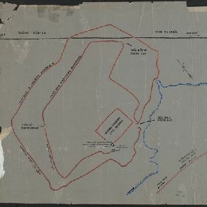
[Outline map of the capital Co-loa, North Vietnam]

event1900

location_onVietnam

This map of the fortified settlement of Cổ Loa (near Hanoi, northern Vietnam) shows the royal city, battlements and gates, a temple and a well. Artefacts dating to the Bronze Age have been found on this early site of Vietnamese civilization.

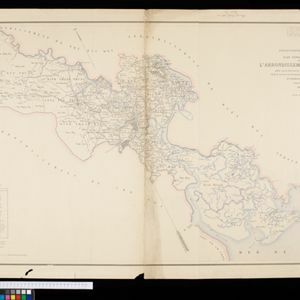
Plan topographique de l'arrondissement de Saigon

event1885

location_onVietnam

Map of the district of Saigon (Ho Chi Minh City, Vietnam), based around the Fleuve Soirap (Soài Rạp River) as it winds its way down to the South China Sea. The city of Saigon is on its banks, surrounded by more rivers, roads, fields and villages.

Algemeene kaart van Nederlandsch Indië

event1879

location_onCambodia, Indonesia, Papua New Guinea, East Timor, Southeast Asia, Thailand, Malaysia, Philippines, Laos, Vietnam, Singapore, Brunei, Myanmar

A late 19th century map of the Dutch East Indies on four sheets, detailing maritime routes around the region. There are also inset maps showing railways, rivers, roads, and telegraph systems, as well as individual islands and cities.

Nederlandsch Oost-Indië

event1865

location_onBrunei, Cambodia, East Timor, Indonesia, Laos, Malaysia, Myanmar, Vietnam, Thailand, Southeast Asia, Singapore, Philippines, Papua New Guinea

This detailed map of the Dutch East Indies in the mid-19th century contains a great deal of information: topographical details, settlements and administrative areas, roads, railways and maritime routes, telegraph lines, inset maps etc.

close