Search

Search Results

The continent and islands of Asia: with all the latest discoveries

event1839

location_onBrunei, Cambodia, East Timor, Indonesia, Laos, Malaysia, Myanmar, Papua New Guinea, Singapore, Philippines, Southeast Asia, Thailand, Vietnam

On this map of Asia, the South China Sea is labelled ‘Malayan Sea’. Small islands, shoals and reefs are shown. A label in Cochin China (Vietnam) reads ‘mountains inhabited by the uncivilized people called Kemoys’.

A map of Java: chiefly from surveys made during the British administration

event1817

location_onIndonesia

Made for ‘A History of Java’ by Sir Stamford Raffles, this map includes a list of administrative districts with their populations, and four inset maps of harbours. Another inset map shows rocks and minerals, mountains and volcanoes, and teak forests.

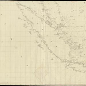
[Sumatra and the Strait of Malacca]

eventc.1800

location_onMalaysia, Singapore, Indonesia

Chart of maritime Southeast Asia, showing bathymetry (sea depth), islands, shoals, reefs, landmarks, and notes (‘Rock seen at Low Water’), all to aid navigation. A rhumbline network has been drawn on the map in pencil. Only one sheet is present.

Plan of the road and city of Batavia on the north coast of Java Island

event1790

location_onIndonesia

Map of the Batavia (Jakarta) Bay roadstead, a body of water sheltered from tides/currents, for ships to anchor. The web of lines is a rhumbline network, the numbers indicate sea depth (bathymetry), and there are written notes, all to aid navigation.

A map of the East Indies, from the best authorities

event1780

location_onBrunei, Cambodia, East Timor, Indonesia, Laos, Malaysia, Myanmar, Philippines, Singapore, Southeast Asia, Thailand, Vietnam

On this map of Asia, Borneo is labelled ‘The Inland Part of this Island is inhabited by the Biayos a savage People’, a description seen on many contemporary maps. The ancient kingdoms of mainland Southeast Asia are also shown.

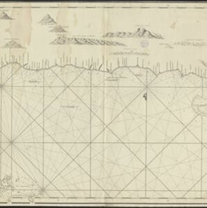
Chart of the North Coast of Java from Samarang to Batavia

event1740

location_onIndonesia

This map uses a variety of methods to aid navigation, including a rhumbline network (a web of lines to help plot routes). The numbers on the sea surface indicate depth (bathymetry), and the drawings of mountains (elevations) were used as landmarks.

To the Right Honourable William, Lord Cowper, Lord High Chancellor of Great Britain, this map of Asia

eventc.1715

location_onVietnam, Myanmar, Papua New Guinea, Philippines, Singapore, Southeast Asia, Thailand, Malaysia, Laos, Indonesia, East Timor, Cambodia, Brunei

The arrows on this map show the direction of the seasonal monsoons: each arrow has a label, indicating the month. The northeast coast of Borneo is labelled ‘A Desart [desert/deserted?] Coast’, while the south is labelled ‘Pepper Country’.

close

  • Filter from 1714 to 1839

Current results range from 1714 to 1839