
Search Results
5 Results found

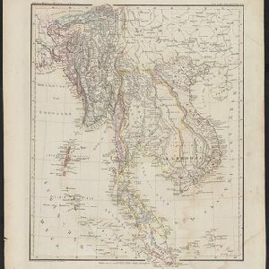
Hinter Indien
1845
Indonesia, Singapore, Malaysia, Thailand, Vietnam, Myanmar, Laos, Cambodia
A mid-19th century German map of mainland Southeast Asia showing a mixture of ancient kingdoms (e.g. Cochin-China), administrative districts (Malay States) and colonial possessions (Straits Settlements). Extensive mountainous areas are also featured.

Hinterindien
1832
Indonesia, Malaysia, Singapore, Cambodia, Vietnam, Thailand, Myanmar, Laos
A mid-19th century German map of mainland Southeast Asia showing a mixture of ancient kingdoms (e.g. Birma, Siam, Anam) and the colonial possessions of Britain (Malaya, Straits Settlements) and Denmark (Nicobar Islands).
- Filter from 1832 to 1899
- [remove]District/Administrative Border5
- [remove]Regional Border5
- Colonial Possessions4


