Search

Search Results

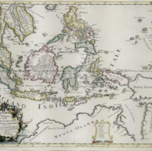
Isole dell'India, cioè le Molucche, le Filippine e della Sonda: parte de Paesi di nuoua scoperta e l'Isole de Ladri nel Mare del Zud

event1683

location_onBrunei, Cambodia, East Timor, Indonesia, Laos, Malaysia, Myanmar, Papua New Guinea, Philippines, Singapore, Southeast Asia, Thailand, Vietnam

Dotted lines on this late 17th century map demarcate regions and kingdoms (which also have a crown symbol). The cartouche is shaped like a giant shell supported by mermen, with cherubs holding up shells and pearls on top.

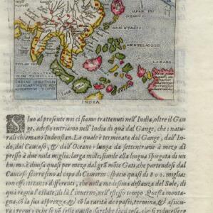
Indiae Orientalis insularumque adiacientium typus

eventc.1596-1640

location_onBrunei, Cambodia, East Timor, Indonesia, Laos, Malaysia, Myanmar, Philippines, Singapore, Southeast Asia, Thailand, Vietnam

Rivers and major settlements are the main feature of this colourful early map of Asia. Italian text gives further details about the region.

Vndecima Asiae Tabvla

event1478

location_onCambodia, Laos, Malaysia, Myanmar, Singapore, Thailand, Vietnam

Based on the work of 2nd century geographer Ptolemy, this map has Latin inscriptions, including mentions of a mythical race of cannibals (‘Anthropophagi’) and hippopotamuses. The Malay Peninsula is labelled ‘Aurea Chersonesus [Golden Chersonese]’.

close

  • Filter from 1478 to 1683

Current results range from 1478 to 1683