Search

Search Results

Asiatic archipelago

event1858

location_onVietnam, Myanmar, Papua New Guinea, Philippines, Singapore, Southeast Asia, Thailand, Malaysia, Laos, Indonesia, East Timor, Cambodia, Brunei

This late 19th century map of Southeast Asia shows the best maritime routes around the region, according to the time of year. There are also inset maps highlighting the rivers and southern islands of Singapore, and the sea depth around Labuan Island.

Singapore harbours and roads with the adjacent channels

event1840

location_onSingapore

An early 19th century map of Singapore’s southern coast and islands, with bathymetry (sea depth), shoals and reefs, anchor points, and notes to aid navigation. The roads and main buildings of Singapore city are also shown.

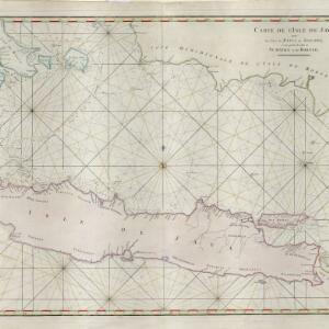
Carte de l'Isle de Java, avec les isles de Banca, de Billiton, et une partie de celles de Sumatra et de Borneo

event1775

location_onIndonesia

This 18th century maritime navigation map charts the waters between the islands of Java, Sumatra and Borneo. A route south towards the Sunda Strait, as taken by the French ship Mascarin in March and April 1772, is highlighted.

close

  • Filter from 1775 to 1858

Current results range from 1775 to 1858