Search

Search Results

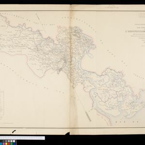
Plan topographique de l'arrondissement de Saigon

event1885

location_onVietnam

Map of the district of Saigon (Ho Chi Minh City, Vietnam), based around the Fleuve Soirap (Soài Rạp River) as it winds its way down to the South China Sea. The city of Saigon is on its banks, surrounded by more rivers, roads, fields and villages.

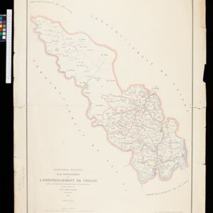
Plan topographique de l'arrondissement de Cholon

event1882

location_onVietnam

Map of the district of Cholon (Chợ Lớn, Ho Chi Minh City, Vietnam). The southern part is more detailed, with rivers, roads and villages, while the north is sparser (though there are ancient Cambodian forts and towers marked).

Itinéraire de Hanoi à That-khe par Lang-son (Frontière Chinoise du Kouang-Si)

event1881

location_onVietnam

A late 19th century map depicting a route from Hanoi to That-Khe via Lang-Son (in northern Vietnam, near the border with China at Kouang-Si (Guangxi)). Two inset maps feature plans of military forts, villages, rivers and fields along the route.

close

  • Filter from 1881 to 1885

Current results range from 1881 to 1885