
Search Results


New sketch map of the protected Malay State of Perak
1892
Malaysia
Map of state of Perak (Malay Peninsula) with a table of statistics: area, population, road/railway/river lengths, revenue, tin exports. Straits Settlements highlighted red. Someone has added handwritten travel times/distances by steamer/road/train.


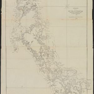
Map of the Malay Peninsula 1879
1879
Malaysia, Singapore, Thailand
Six-sheet map of the Malay Peninsula, featuring settlements, mountains and rivers. Labels note names of indigenous peoples, or describe terrain/resources. There is an inset map of Singapore town, and the Straits Settlements are highlighted in red.

Burmah, Siam and Cochin China
1875
Cambodia, Laos, Malaysia, Myanmar, Thailand, Vietnam
This map of mainland Southeast Asia features short texts noting mines, trade routes and travel times (‘5 to 7 days on Elephants’), history (‘conquered by the King of Siam 1809’), peoples (‘states tributary to the Chinese’) and products (‘Tea Tree’).
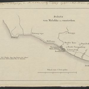
A map of a part of the Malay Peninsula belonging to Siam: copied from a map of the Siamese government in 1870
1873
Malaysia
A hand drawn map showing mountains, rivers, roads and settlements in the northern part of the Malay Peninsula belonging to Siam (Thailand). This map was copied from one made by the Siamese government in 1870.


Nederlandsch Oost-Indië
1865
Brunei, Cambodia, East Timor, Indonesia, Laos, Malaysia, Myanmar, Vietnam, Thailand, Southeast Asia, Singapore, Philippines, Papua New Guinea
This detailed map of the Dutch East Indies in the mid-19th century contains a great deal of information: topographical details, settlements and administrative areas, roads, railways and maritime routes, telegraph lines, inset maps etc.

Extension of the Electric Telegraph to Canton, Hong Kong, etc. from the Port of Rangoon
1860
Myanmar, Cambodia, Indonesia, Laos, Malaysia, Singapore, Thailand, Vietnam
Map of a proposed extension of a telegraph system from Rangoon (Yangon, Myanmar) to China. Includes current and projected railways, steam ship routes, and population figures for western China. From the British magazine ‘The Illustrated London News’.


