Search

Search Results

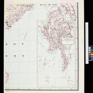
[Map of India]

event1887

location_onMyanmar

This four-sheet map of India—featuring an inset map of Burma (Myanmar) —was created for use in Indian schools by Devendranath Dhar, a self-taught Calcutta-based mapmaker. He sent it to the Royal Asiatic Society for advice on publication.

Map of Prince of Wales' Island or Pulo Penang and province Wellesley

event1853

location_onMalaysia

Map of the Penang Strait, including written instructions on how to navigate the strait. On land, areas of cultivation are marked, with a table listing acreage used for each crop. A boundary with Siam based on an 1831 treaty is also shown.

close

  • Filter from 1853 to 1887

Current results range from 1853 to 1887