Search

Search Results

Carte des environs de Batavia = Kaart van de buitenstreeken van Batavia

eventc.1772-1780

location_onIndonesia

This late 18th century map of Batavia (Jakarta) focusses on the network of canals and rivers surrounding the city, as well as the many fields and plantations, including rice fields (‘Champ de Ris’) and sugarcane (‘Cannes de Sucre’).

Der Hollaendisch-Ostindianischen Compagnie weltberühmte Haupt-Handels und Niederlags: Stadt Batavia

event1747

location_onIndonesia

The legend and written notes on this plan of Batavia (Jakarta) provide much detailed information about the important port city in the early 18th century. It is also beautifully decorated with paintings of the city, local people, animals and ships.

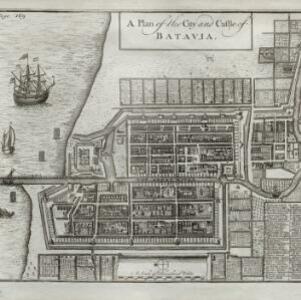
A plan of the city and castle of Batavia

event1746

location_onIndonesia

A mid-18th century plan of Batavia (Jakarta), the main port of the Dutch East India Company's trading network in Southeast Asia. Ships can be seen transporting goods along ‘The Great River’ to the sea, overseen by Batavia Castle at the river’s mouth.

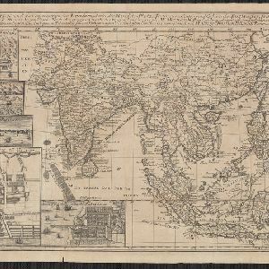
Charte von Ost-Indien und den angroentzenden Laendern

event1737

location_onBrunei, Cambodia, East Timor, Indonesia, Laos, Malaysia, Myanmar, Philippines, Singapore, Southeast Asia, Thailand, Vietnam

The London-based cartographer Herman Moll (1654?–1732) created this map of Asia in the early 18th century. There are five insets showing Asian trading cities, including of the ports of Batavia (Jakarta) and Bantam (Banten) in western Java.

Der Hollaendisch-Ostindianischen Compagnie weltberühmte Haupt-Handels und Niederlags: Stadt Batavia

event1733

location_onIndonesia

The legend and written notes on this plan of Batavia (Jakarta) provide much detailed information about the important port city in the early 18th century. It is also beautifully decorated with paintings of the city, local people, animals and ships.

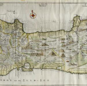
Nieuwe en zeer naaukeurige kaart van t eyland Java Major of Groot Java: verdeeld in seven byzondere bestekken

event1728

location_onIndonesia

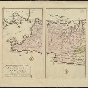
On this beautifully illustrated and coloured map of Java, mountains, trees, fields of crops and settlements are shown pictorially. The coasts are marked with shoals, reefs, bathymetry (sea depth, in figures) and anchor points.

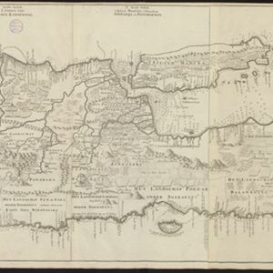
Nieuwe en zeer naaukeurige kaart van t eyland Java Major of Groot Java: verdeeld in seven byzondere bestekken

eventc.1726

location_onIndonesia

On this beautifully illustrated and detailed map of Java, mountains, trees, fields of crops and settlements are shown pictorially. The coasts are marked with shoals, reefs, bathymetry (sea depth, in figures) and anchor points.

Ware affbeeldinge wegens het casteel ende stadt Batavia gelegen opt groot eylant Java anno 1669

event1670

location_onIndonesia

A plan of the important port of Batavia (Jakarta), with the fort, river, city streets and fields. Decorative illustrations include ships in the harbour, a view of the city and mountains, and the city’s coat of arms: a lion holding a sword and shield.

close