
Search Results
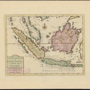
Nieuwe kaart van de Sundasche eilanden als Borneo, Sumatra en Groot Iava &c.
c.1731-1769
Brunei, Cambodia, Indonesia, Malaysia, Singapore, Thailand
On this mid-18th century map of the Sunda Islands, a label on the island of Borneo states ‘Beajous Afgoden dienars bewonende het middelste gedeelte vant Eilland [Beajous idolaters inhabit the middle part of the Island]’.

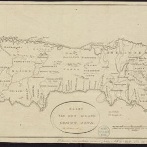
Nieuwe en zeer naaukeurige kaart van t eyland Java Major of Groot Java: verdeeld in seven byzondere bestekken
c.1726
Indonesia
On this beautifully illustrated and detailed map of Java, mountains, trees, fields of crops and settlements are shown pictorially. The coasts are marked with shoals, reefs, bathymetry (sea depth, in figures) and anchor points.


