Search

Search Results

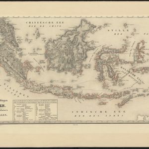
Kaart der Nederlandsche bezittingen in Oostindien = Possessions hollanaises aux Indes Orientales

event1840

location_onBrunei, East Timor, Indonesia, Malaysia, Singapore

Map of Dutch colonial territory in Southeast Asia, including the administrative areas of Java and Madura. Two maritime routes are marked from Batavia to the Maluku Islands: of the brig ‘Douga’ in 1825, and by Baron Godert van der Capellen in 1824.
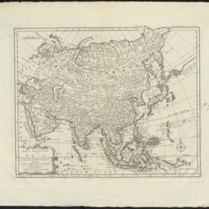
Nieuwe en naukeurige kaart van Asia

event1773

location_onIndonesia, Brunei, Cambodia, East Timor, Laos, Malaysia, Myanmar, Papua New Guinea, Philippines, Singapore, Southeast Asia, Thailand, Vietnam

Map of Asia featuring an early—and very vague—depiction of New Britain (‘Nieuw Brittanje’) which was named by the British explorer William Dampier when he visited in 1700. The ‘Straat van Dampier’ is also shown, dividing New Britain from New Guinea.

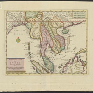
Nieuwe kaart van India over de Ganges: of van Malakka, Siam, Cambodia, Chiampa, Kochinchina, Laos, Pegu, Ava enz.

event1739

location_onBrunei, Cambodia, Indonesia, Laos, Malaysia, Myanmar, Singapore, Thailand, Vietnam, Philippines

On this map, mainland Southeast Asia is divided into regions such as Cochin China, Ciampa and Tunquin (modern Vietnam), Siam (Thailand), Pegu, Aracan and Ava (Myanmar), Malacca (Malaysia), Laos and Cambodia. Rivers and settlements are also shown.

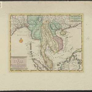
Nieuwe kaart van India: over de Ganges, of van Malakka, Siam, Cambodia, Chiampa, Kochinchina, Laos, Pegu, Ava enz.

event1739

location_onBrunei, Cambodia, Indonesia, Laos, Malaysia, Myanmar, Singapore, Thailand, Vietnam, Philippines

On this map, mainland Southeast Asia is divided into regions such as Cochin China, Ciampa and Tunquin (modern Vietnam), Siam (Thailand), Pegu, Aracan and Ava (Myanmar), Malacca (Malaysia), Laos and Cambodia. Rivers and settlements are also shown.

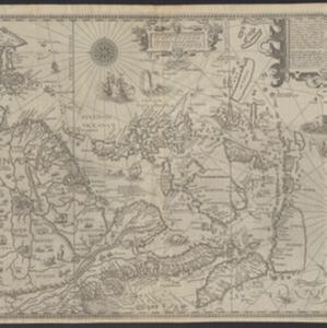
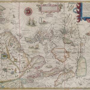
Exacta & accurata delineatio cùm orarum maritimarum tùm etiam locorum terrestrium quae in regionibus China, Cauchinchina, Camboia sive Champa, Syao, Malacca, Aracan & Pegu

event1596

location_onBrunei, Cambodia, East Timor, Indonesia, Laos, Malaysia, Myanmar, Philippines, Singapore, Southeast Asia, Thailand, Vietnam

Unusually, north is located to the left of this map of East Asia, rather than the top. The text notes that shallows and reefs are marked, and that the map is based on the explorations of Portuguese ships. Illustrations include sea monsters and ships.

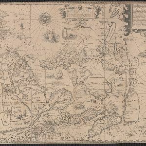
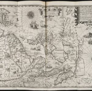
Exacta & accurata delineatio cùm orarum maritimarum tùm etiam locorum terrestrium quae in regionibus China, Cauchinchina, Camboia sive Champa, Syao, Malacca, Aracan & Pegu

event1595

location_onBrunei, Cambodia, East Timor, Indonesia, Laos, Malaysia, Myanmar, Philippines, Singapore, Southeast Asia, Thailand, Vietnam

Unusually, north is located to the left of this map of East Asia, rather than the top. The text notes that shallows and reefs are marked, and that the map is based on the explorations of Portuguese ships. Illustrations include sea monsters and ships.

close