Search

Search Results

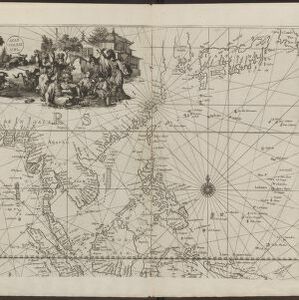
Suite de l'Ocean Oriental contenant les Isles de la Sonde, les costes de Tunquin et de la Chine, les isles du Japon, les Philippines, Moluques

event1746

location_onBrunei, Cambodia, East Timor, Indonesia, Malaysia, Papua New Guinea, Philippines, Singapore, Southeast Asia, Thailand, Vietnam

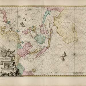
The coast of New Guinea (‘Nova Guinéa’) is represented in part by a dotted line on this mid-18th century map, indicating that the exact coastlines were unknown at this time. Originally in French, the map has been modified to add Dutch text as well.

Nieuwe kaart van Asia na de alderlaatste ondekking int licht gebracht

event1733

location_onBrunei, Cambodia, East Timor, Indonesia, Laos, Malaysia, Myanmar, Papua New Guinea, Philippines, Singapore, Southeast Asia, Thailand, Vietnam

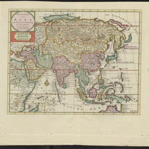
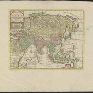
Map of Asia showing New Guinea (‘Nieuw Guinee’) and Australia (‘Nieuw Holland’) as one landmass, demonstrating that there was some uncertainty about the area’s geography in the early 18th century. However, it does include New Britain (‘N. Bretanje’).

Nieuwe kaart van Asia na de alderlaatste ondekking int licht gebracht

event1733

location_onBrunei, Cambodia, East Timor, Indonesia, Laos, Malaysia, Myanmar, Papua New Guinea, Singapore, Philippines, Southeast Asia, Thailand, Vietnam

Map of Asia showing New Guinea (‘Nieuw Guinee’) and Australia (‘Nieuw Holland’) as one landmass, demonstrating that there was some uncertainty about the area’s geography in the early 18th century. However, it does include New Britain (‘N. Bretanje’).

Nieuwe kaart van Asia na de alderlaatste ondekking int licht gebracht

event1733

location_onBrunei, Cambodia, East Timor, Indonesia, Laos, Malaysia, Myanmar, Papua New Guinea, Philippines, Singapore, Southeast Asia, Thailand, Vietnam

Map of Asia showing New Guinea (‘Nieuw Guinee’) and Australia (‘Nieuw Holland’) as one landmass, demonstrating that there was some uncertainty about the area’s geography in the early 18th century. However, it does include New Britain (‘N. Bretanje’).

Nieuwe kaart van Asia na de alderlaatste ondekking int licht gebracht

event1733

location_onBrunei, Cambodia, East Timor, Indonesia, Laos, Malaysia, Myanmar, Papua New Guinea, Singapore, Philippines, Southeast Asia, Thailand, Vietnam

Map of Asia showing New Guinea (‘Nieuw Guinee’) and Australia (‘Nieuw Holland’) as one landmass, demonstrating that there was some uncertainty about the area’s geography in the early 18th century. However, it does include New Britain (‘N. Bretanje’).

Nieuwe kaart van Asia na de alderlaatste ondekking int licht gebracht

event1733

location_onBrunei, Cambodia, East Timor, Indonesia, Laos, Malaysia, Myanmar, Papua New Guinea, Philippines, Singapore, Southeast Asia, Thailand, Vietnam

Map of Asia showing New Guinea (‘Nieuw Guinee’) and Australia (‘Nieuw Holland’) as one landmass, demonstrating that there was some uncertainty about the area’s geography in the early 18th century. However, it does include New Britain (‘N. Bretanje’).

Deese wassende pas-kaart van Oost-Indien, is nu te bekoomen voor die deselve begeeren

eventc.1728-1738

location_onBrunei, Cambodia, East Timor, Indonesia, Laos, Malaysia, Myanmar, Papua New Guinea, Philippines, Singapore, Southeast Asia, Thailand, Vietnam

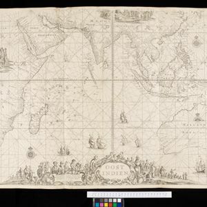
Map of the Indian Ocean dominated by a rhumbline network—a web of interconnected lines used to help plot routes—with a compass rose at the centre. At the top there are (incomplete) drawings of people with text in Dutch, French, English and Spanish.

Orientaliora Indiarum Orientalium cum insulis adjacentibus à promontorio C. Comorin ad Iapan = Pascaert van t'Ooster gedeelte van Oost Indien van C. Comorin tot Iapan

event1715

location_onBrunei, Cambodia, East Timor, Indonesia, Laos, Malaysia, Myanmar, Philippines, Singapore, Southeast Asia, Thailand, Vietnam

The cartouche on this early 18th century navigation map features the title in Latin and Dutch, as well as a wealth of detailed drawings illustrating the region’s trade: Asian merchants, their goods and animals, and two female European customers.

Platte globus van hemel en aarde noyt alsoo gesien waar op heel licht kan geleert worden d'loop des hemels en zee-vaart op alle polus-hooghten

event1697

location_onBrunei, Cambodia, Indonesia, Laos, Malaysia, Myanmar, Philippines, Southeast Asia, Thailand, Vietnam, Singapore, East Timor

A richly illustrated circular map of the world, surrounded by a ring of stars and sky, and spread over four sheets. The corners contain drawings of Atlas and Hercules holding the Earth on their shoulders, and of various philosophers and astronomers.

Oost Indien: Wassende-graade paskaart, Vertoonende nevens het oostelyckste van Africa, meede de zeekusten van Asia

eventc.1678-1704

location_onBrunei, Cambodia, East Timor, Indonesia, Laos, Malaysia, Myanmar, Philippines, Singapore, Southeast Asia, Thailand, Vietnam

This map focuses on maritime trade, with detailed coastal areas (and blank interiors), illustrations of sailing ships, a rhumbline network—a web of lines used to aid navigation—and an elaborate cartouche illustrated with traders and their wares.

Oost Indien

event1668

location_onBrunei, Cambodia, East Timor, Indonesia, Laos, Malaysia, Myanmar, Philippines, Singapore, Southeast Asia, Thailand, Vietnam

Map of Asia illustrated with four large allegorical drawings representing the Dutch East India Company, by the Dutch Baroque artist Romeyn de Hooghe. Includes scenes of Asian merchants, the capturing of crocodiles and elephants, and mythology.

close