Search Results
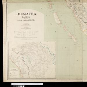
Soematra, Bangka en de Riouw-Lingga Archipel
1897
Malaysia, Indonesia, Singapore, Myanmar
Map of Sumatra and surrounding islands, with residencies—administrative districts—shown by coloured borders. There are inset maps of two residencies surrounding Padang, and of Groot-Atjeh (Aceh). Rivers, railways, roads and settlements are marked.
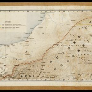
Kaart van een gedeelte van Borneo: met aanwijzing van de grens tusschen het Nederlandsch gebied en dat van het Britsche Protectoraat
1891
Indonesia, Malaysia, Myanmar
Map marking the border (in orange) agreed between British and Dutch territory on Borneo in 1891. Alternative borders are shown: according to the Dutch (blue), according to the British North Borneo Society (yellow) and proposed by the British (green).
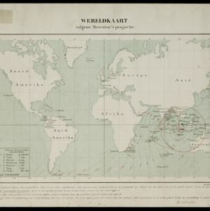
Wereldkaart volgens Mercator's projectie
1883
Brunei, Cambodia, East Timor, Indonesia, Laos, Malaysia, Myanmar, Papua New Guinea, Philippines, Singapore, Southeast Asia, Thailand, Vietnam
A map charting the effects of the 1883 Krakatoa volcanic eruption: a red circle where the eruption was heard; black lines showing the hourly spread of the resulting waves; and a list of ships on which ash fell, or that encountered pumice (with date).

Algemeene kaart van Nederlandsch Indië
1879
Cambodia, Indonesia, Papua New Guinea, East Timor, Southeast Asia, Thailand, Malaysia, Philippines, Laos, Vietnam, Singapore, Brunei, Myanmar
A late 19th century map of the Dutch East Indies on four sheets, detailing maritime routes around the region. There are also inset maps showing railways, rivers, roads, and telegraph systems, as well as individual islands and cities.
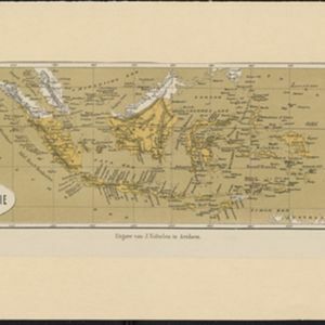
Oost-Indie
c.1867
Brunei, Cambodia, East Timor, Indonesia, Laos, Malaysia, Myanmar, Philippines, Singapore, Southeast Asia, Thailand, Vietnam
Map of the East Indies in the mid-19th century, with Dutch colonial territory (Dutch East Indies) coloured in brown. Dutch administrative regions—such as residencies (‘residentie’) and governorates (‘gouvernement’)—are labelled.

Nederlandsch Oost-Indië
1865
Brunei, Cambodia, East Timor, Indonesia, Laos, Malaysia, Myanmar, Vietnam, Thailand, Southeast Asia, Singapore, Philippines, Papua New Guinea
This detailed map of the Dutch East Indies in the mid-19th century contains a great deal of information: topographical details, settlements and administrative areas, roads, railways and maritime routes, telegraph lines, inset maps etc.
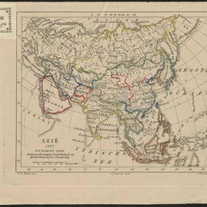
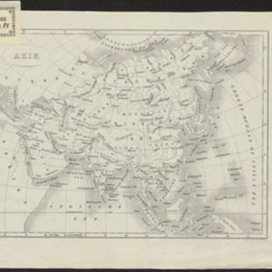
Azië : 1861
1861
Brunei, Cambodia, East Timor, Indonesia, Laos, Malaysia, Myanmar, Papua New Guinea, Philippines, Singapore, Southeast Asia, Thailand, Vietnam
Map of Asia published by the North Holland Regional Association of the Dutch Teachers' Association. Mainland Southeast Asia is labelled ‘Achter Indie [Beyond India]’; the Indonesian Archipelago is labelled ‘Indische Archipel [Indian Archipelago]’.
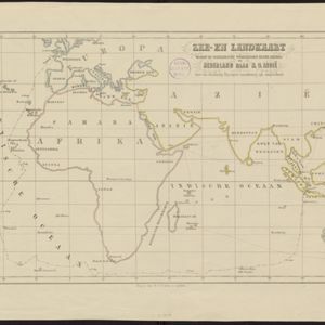
Zee- en landkaart waarop de dagelijksche vorderingen eener zeereis van Nederland naar N.O. Indië door een deskundig passagier naauwkeurig aangeteekend
c.1860
Brunei, Cambodia, East Timor, Indonesia, Laos, Malaysia, Myanmar, Philippines, Singapore, Southeast Asia, Thailand, Vietnam
Map of the Eastern Hemisphere featuring a maritime route from the Netherlands to the port of Batavia (Jakarta) in the East Indies, with each day’s progress marked. Other routes around the region and back to Europe via the Suez Canal are also shown.
- Filter from 1595 to 1900
- [remove]Malaysia67
- [remove]Myanmar67
- Cambodia65
- Laos65
- Thailand65
- Vietnam65
- Indonesia64
- Philippines63
- Singapore63
- Brunei62
- East Timor58
- Southeast Asia58
- more Simple Location »

