Search

Search Results

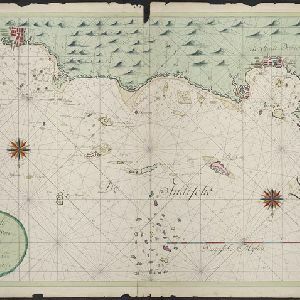
Nieuwe afteekeningh van de Noord Küst van Java vertoonende de reede van Batavia en Bantem

event1740

location_onIndonesia

A map of the northern coast of Java and the important port cities of Batavia (Jakarta) and Bantem (Banten). The web of lines is a rhumbline network, and shoals, reefs and bathymetry (sea depth) are marked, all to aid navigation.

Insulae Iavae pars Occidentalis

eventc.1710-1719

location_onIndonesia

A map of Java with mountains, jungles, animals and crops. Bathymetry (sea depth) is marked, including on an inset map of Batavia harbour. Illustrations include Batavia Castle, and a lion—representing Belgium—receiving tribute and enslaving locals.

[Philippine Islands]

event1665

location_onPhilippines

A map of the northern Philippine islands with a rhumbline network, a web of lines to aid navigation. Bathymetry (sea depth), shoals and reefs are marked, reinforcing the maritime theme. The compass rose points left, indicating north’s direction.

close

  • Filter from 1665 to 1740

Current results range from 1665 to 1740