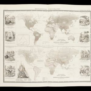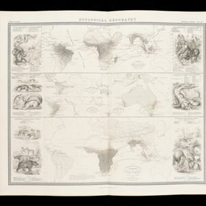
Zoological Geography: Sheet No. 1
1849
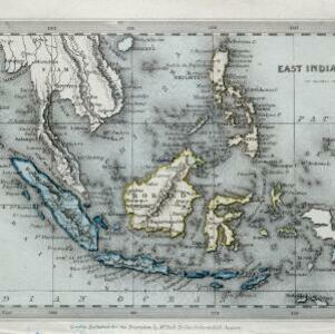
Brunei, Cambodia, East Timor, Indonesia, Laos, Malaysia, Myanmar, Papua New Guinea, Philippines, Singapore, Southeast Asia, Thailand, Vietnam
Five maps showing the distribution of animal species, including in Southeast Asia, covering primates, marsupials, pachyderms and Edentata. Lines show the geographical range of individual species, alongside illustrations of the animals featured.