Search

Search Results

Strait of Malacca: Sheet II

event1823

location_onMalaysia, Singapore, Indonesia

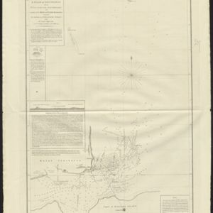
This map of the Straits of Malacca features shoals and reefs, bathymetry (sea depth), drawings of side views of landmark mountains (elevations) and written observations, all designed to aid navigation. Pencil marks indicate the map was actually used.

Strait of Malacca: Sheet II

event1823

location_onMalaysia, Singapore, Indonesia

This map of the Straits of Malacca features shoals and reefs, bathymetry (sea depth), drawings of side views of landmark mountains (elevations) and written observations, all designed to aid navigation.

A plan of soundings from Pulo Aor to the Southward, and outside of the Reef off Point Romania towards the entrance of Sincapour Strait

event1818

location_onMalaysia, Indonesia, Singapore

Navigation chart of part of the South China Sea leading to the eastern entrance of the Singapore Strait. Features bathymetry (sea depth), anchor points, shoals and other obstructions, landmark hills, and detailed explanatory notes.

Chart of East Indian Islands exhibiting the several Passages between the Indian and Pacific Oceans

event1800

location_onBrunei, Cambodia, East Timor, Indonesia, Laos, Malaysia, Myanmar, Philippines, Singapore, Southeast Asia, Thailand, Vietnam

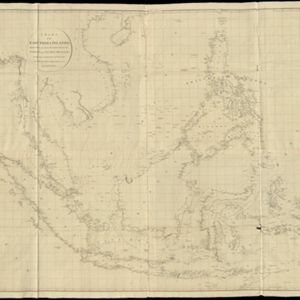
Map focusing on the passages between the islands of maritime Southeast Asia. Many 18th century routes are labelled with the ship/captain’s name and date, and there are notes on some shoals and reefs recording names, details and incidents/shipwrecks.

[Sumatra and the Strait of Malacca]

eventc.1800

location_onMalaysia, Singapore, Indonesia

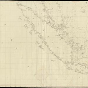
Chart of maritime Southeast Asia, showing bathymetry (sea depth), islands, shoals, reefs, landmarks, and notes (‘Rock seen at Low Water’), all to aid navigation. A rhumbline network has been drawn on the map in pencil. Only one sheet is present.

A new chart of the Oriental Seas and Islands... from the Isle of Ceylon to Amoye in China

event1790

location_onBrunei, Cambodia, East Timor, Indonesia, Laos, Malaysia, Myanmar, Philippines, Singapore, Southeast Asia, Thailand, Vietnam

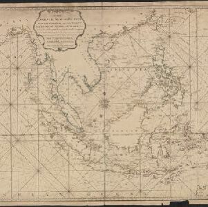
A late 18th century maritime map of Southeast Asia, marked with expedition routes including the return of Captain Cook’s HMS Endeavour from Australia in 1770, and Captain Philip Carteret’s circumnavigation expedition in 1768.

A general chart of the Atlantic and Indian oceans, with the situation & plan of Pulo Peenang or Price of Wales's Island / Plan of the Strait within Poolo Pinang

event1788

location_onMalaysia, East Timor, Indonesia, Papua New Guinea, Singapore

Two maps. One features most of the world, but with Borneo, Philippines and most of mainland Southeast Asia missing, though there is an inset map of Penang. The other is a navigation map of the strait at Penang, with bathymetry and elevations.

close