Search

Search Results

Burma-China Boundary Commission

event1900

location_onMyanmar

A topographic map of the Burma-China border spread over five sheets. High points are marked with their heights so they can be used for triangulation. Settlements, rivers, trade routes and footpaths are also shown.

Burma-China Boundary Commission: Reconnaissance map. Southern party

event1900

location_onMyanmar

A topographic reconnaissance map of the Burma-China border. High points are marked with their heights so they can be used for triangulation. Settlements, rivers, trade routes and footpaths are also shown.

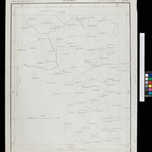
Map of the Kingdom of Siam and its dependencies

eventc.1900

location_onMyanmar, Malaysia, Singapore, Thailand, Laos, Cambodia, Vietnam

The border of the Kingdom of Siam (Thailand) and its internal administrative districts are highlighted in yellow. Inset maps show the cities of Bangkok, Chiengmai (Chiang Mai) and Luang Pra Bang (Luang Prabang) in more detail.

India to illustrate the gauges of railways

event1899

location_onMyanmar

This map of India and Burma (Myanmar) shows railways, and railways sanctioned or under construction. The lines on Myanmar are all metre gauge. There is also a list of the railway lines shown, with their route and length.

Stanford's Library Map of Asia

event1899

location_onBrunei, Cambodia, East Timor, Indonesia, Laos, Malaysia, Myanmar, Philippines, Singapore, Southeast Asia, Thailand, Vietnam

Southeast Asia is on sheet four of this map. British colonial territory—British Burma, the Straits Settlements, Sarawak, Brunei, British North Borneo—is highlighted in red, with Dutch, Spanish, French and Portuguese territory also shown.

Map of Singapore and surrounding country

event1899

location_onMalaysia, Singapore, Indonesia

Map of Singapore Island, including the surrounding islands and straits, and southern Johor. Lighthouses are marked in red and yellow, including Horsburgh Lighthouse on Pedra Branca, Raffles Lighthouse and Fort Canning Lighthouse.

A map of British North Borneo

event1899

location_onMalaysia, Brunei, Indonesia

The colonial territories of British North Borneo are shown in pink on this late 19th century map, with Brunei and Sarawak in green, and Dutch colonial territory in yellow. Sea routes around the British Empire are depicted on an inset map.

Upper Burma

event1899

location_onMyanmar, Thailand

Map of Upper Burma, showing the borders with Assam (India), China and Siam (Thailand), as well as internal administrative borders. Mountains with their heights, settlements, rivers and railways (completed, proposed and under construction) are shown.

India shewing railways with stations

event1899

location_onMyanmar

This map focuses on India, but also includes Burma (Myanmar), showing the country’s railway lines with their stations, including engine changing stations and junction stations. Part of a series of maps charting the development of the railway system.

Skeleton map of India

event1899

location_onMyanmar

On this map of India, Burma (Myanmar) is divided into two regions: ‘British Burma’—under British colonial rule after the Second Anglo-Burmese War (1852)—and Upper Burma (labelled ‘Burma’), under British rule after the Third Anglo-Burmese War (1885).

Chart of triangulation: No.21 Party, Northern Shan States (Upper Burma)

event1899

location_onMyanmar

A triangulation map of part of Upper Burma (Myanmar), showing dozens of locations joined with straight lines to create a triangulation network.

Sketch map of China and adjoining regions: showing the density of population, mineral resources, chief products, principal trade routes, existing and projected railways, and inland navigation

event1898

location_onMyanmar, Thailand, Vietnam

This map of China features a small part of northeastern Southeast Asia. Population density is shown, along with rivers, trade routes, tidal river navigation limits, railways (existing and suggested), and two coal mines in Tong-King (Vietnam).

close

  • Filter from 1676 to 1900

Current results range from 1676 to 1900