Search Results

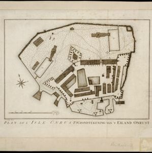
Plan de l'Isle Onrust = Grondtékening van 't Eiland Onrust
1760
Indonesia
Map of the Dutch town and naval base on the island of Onrust in Batavia (Jakarta) Bay, featuring the dock at the south, and various other buildings. There are defences around the north and east coasts, and internal walls around the main buildings.
- [remove]Dutch East Indies3
- Java3
- Batavia2
- Ile de Java2
- Ile de Madura2
- Jakarta2
- Madura2
- Batavia Bay1
- Eiland Onrust1
- Isle Onrust1
- Jakarta Bay1
- Onrust Island1
- [remove]Military Fort3
- Hospital2
- Kampong/Village2
- Residential Area2
- Military Barracks1


