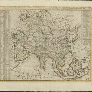
Carte de l'Asie selon les auteurs anciens enrichie de remarques historiques sur les changemens qui y sont arrivez
1732
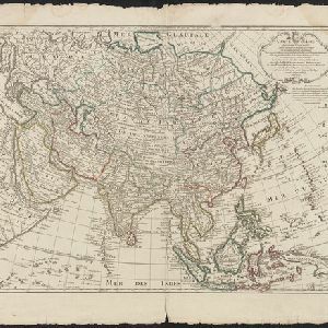
Brunei, Cambodia, East Timor, Indonesia, Laos, Malaysia, Myanmar, Philippines, Singapore, Southeast Asia, Thailand, Vietnam
Map of Asia with notes on the history of the region. Some place names are unusual: Sumatra = ‘Chersonese’, Philippines = ‘Iles Sabadibes’, Maluku Islands = ‘Iles Barusses’, Sunda Islands = ‘Iles Sindes’, Malay Peninsula = ‘Dorée’, Borneo = ‘Sinde I’.