Search

Search Results

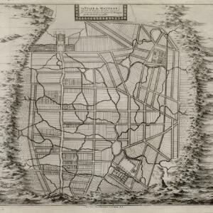
La ville de Materan, capitale du roiaume de même nom, avec ses environs: le tout environné de montagnes qui lui serve de murailles

event1729

location_onIndonesia

This map of the city of Mataram, on the Indonesian island of Lombok, shows the city surrounded by detailed illustrations of mountains which, the map’s subtitle notes, ‘serve de murailles’ [serve as its walls].

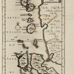
Les Îles Moluques, tres exactement representées selon les plus nouvelles Observations des meilleurs Geographes

eventc.1714-1729

location_onIndonesia

A map of a small island chain off the west coast of the island of Gilola (modern Halmahera in the Maluku Islands of Indonesia). The military forts on the islands were used by the European colonial powers during conflicts over the area’s spice trade.

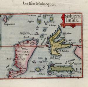
Moluccæ insulæ

event1602

location_onIndonesia

This early 17th century map features Gilolo (Halmahera) and Seram, as well as Celebes (Sulawesi). French text on the reverse describes the ‘Isles Molucques’ (Maluku Islands), including trade in nutmeg, mace, aloe, cinnamon, ginger, pepper and cloves.

close

  • Filter from 1602 to 1729

Current results range from 1602 to 1729