Search

Search Results

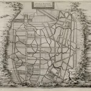
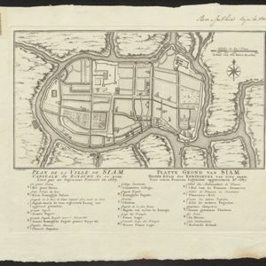
Plan de la Ville de Siam: Capitale du Royaume de ce nom = Platte grond van Siam: Hoofd stad des Koningryks van dien' naam

event1687

location_onThailand

Map of the Siamese city of Ayutthaya (‘Ville de Siam’), surrounded by the Menam River (Chao Phraya River). Roads and buildings are marked, including a number of royal palaces and pagodas, which are listed on the Dutch and French-language legend.

Carte de l'ile de Java: partie occidentale, partie orientale, dressée tout nouvellement sur les mémoires les plus exacts

event1719

location_onIndonesia

The mountains and forests of early 18th century Java are beautifully illustrated here by the Dutch cartographer Henry Abraham Chatelain (1648-1743). Details include cities, fields of crops, animals and people. An inset map shows the port of Batavia.

Carte de l'ile de Java: partie occidentale, partie orientale, dressée tout nouvellement sur les mémoires les plus exacts

event1720

location_onIndonesia

The mountains and forests of early 18th century Java are beautifully illustrated here by the Dutch cartographer Henry Abraham Chatelain (1648-1743). Details include cities, fields of crops, animals and people. An inset map shows the port of Batavia.

Carte de l'ile de Java: partie occidentale, partie orientale, dressée tout nouvellement sur les mémoires les plus exacts

event1726

location_onIndonesia

The mountains and forests of early 18th century Java are beautifully illustrated here by the Dutch cartographer Henry Abraham Chatelain (1648-1743). Details include cities, fields of crops, animals and people. An inset map shows the port of Batavia.

La ville de Materan, capitale du roiaume de même nom, avec ses environs: le tout environné de montagnes qui lui serve de murailles

event1729

location_onIndonesia

This map of the city of Mataram, on the Indonesian island of Lombok, shows the city surrounded by detailed illustrations of mountains which, the map’s subtitle notes, ‘serve de murailles’ [serve as its walls].

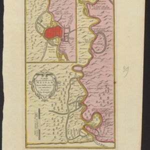
Carte du cours de la Riviere de Meinam: depuis Judia jusqu'à son embouchure

event1730

location_onThailand

Map of the Meinam (Chao Phraya) river from the city of Judia (Ayutthaya) to its mouth near Bangkok. Features temples, villages, a Bishop's Palace, a fort at Bangkok, and a ‘Champ des Eléphans [Elephant Field]’. The text is in French and Dutch.

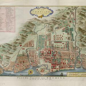
Plan d'Amboine, tel qu'il étoit en 1718 = Platte-grond van Amboina, zoo als het was in den jaare 1718

eventc.1746-1770

location_onIndonesia

This colourful mid-18th century plan of the city of Amboine (Ambon, capital of Ambon Island, in the Maluku Islands, Indonesia) has a detailed legend identifying locations within the city and the surrounding mountains. The text is in French and Dutch.

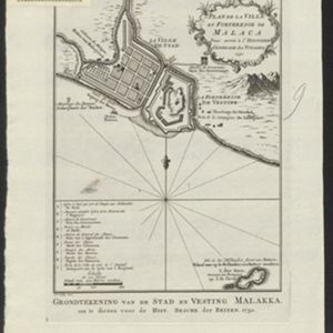
Plan de la ville et forteresse de Malaca = Grondtekening van de Stad en Vesting Malakka

event1750

location_onMalaysia

This mid-18th century plan of the city of Malaca (Malacca/Melaka) focuses on the military fort (‘A Famosa [The Famous]’), but also includes two churches, a mosque and a Chinese temple. Two markets are also marked, as is the entrance to the port.

close

  • Filter from 1687 to 1881

Current results range from 1687 to 1881