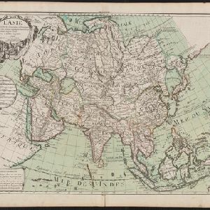
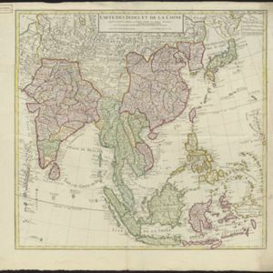
L'Asie: Suivant les nouvelles decouvertes sur les observation de Mrs. de l'Academie Royale des Sciences
c.1700
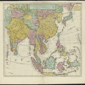
Brunei, Cambodia, East Timor, Indonesia, Laos, Malaysia, Myanmar, Philippines, Singapore, Southeast Asia, Thailand, Vietnam
Map of Asia based on new discoveries and observations of members of the French Academy of Sciences. On mainland Southeast Asia, many royal kingdoms are shown. New Guinea is labelled ‘Le Nou[velle] Zeelande’.