Search

Search Results

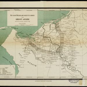
Het door Nederland bezette gebied van Groot-Atjeh met de naaste omgeving

event1899

location_onIndonesia

Map focusing on Kota Radja (city of Banda Aceh, Sumatra) during the Aceh War (1873–1904) fought between the Sultanate of Aceh and Dutch colonists. Dutch forts are shown in a zone around the city, and villages are marked in the surrounding country.

Overzichtskaart van Groot-Atjeh en aangrenzende kuststaten

event1898

location_onIndonesia

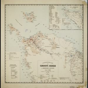
Map of Groot-Atjeh (Aceh, Sumatra), focusing on the area around the capital Kota Radja (Banda Aceh) and along the coasts. There is a list of telephone connections in the area, and an inset map of the region divided into administrative districts.

Overzichtskaart van Groot-Atjeh

event1884

location_onIndonesia

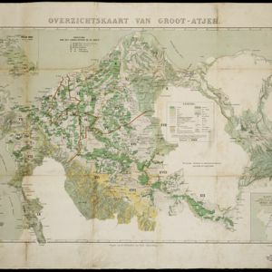
Map of Groot-Atjeh (Aceh, Sumatra) divided into administrative districts. Mountains, forests, villages, railways, roads and rivers are marked. There are inset maps of Poeloe Bras (Breueh Island), and showing distances between larger settlements.

Tocht van de expeditie kolonne over Seglie naar Telok Kadjoe van 6-24 Mei 1878

event1879

location_onIndonesia

Map of a Dutch military expedition from Seglie (Sigli) on the northeast coast of Sumatra to Telok Kadjoe, during the Aceh War between Aceh and Dutch colonists. They land at Sigli and cross marshland, high grass, and rice and sugarcane fields.

[Views of ports in Sumatra]

event1700

location_onIndonesia

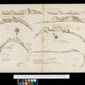
Six drawings of bays, including the Bay of Tiku (‘Rade de Ticou’) on the west coast of Sumatra, showing Tiku between the mountains Pagaman and Priaman. Two other drawings are marked ‘Poulo Clauis’ and are possibly bays on the coast of Aceh, Sumatra.

close

  • Filter from 1700 to 1898

Current results range from 1700 to 1898