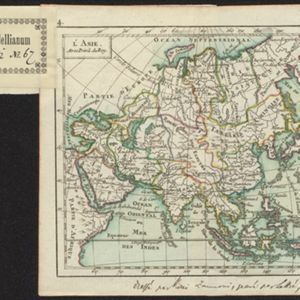
L'Asie
1762
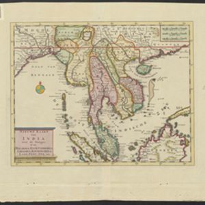
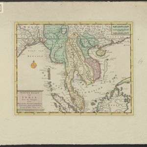
Brunei, Cambodia, East Timor, Indonesia, Laos, Malaysia, Myanmar, Philippines, Singapore, Southeast Asia, Thailand, Vietnam
A hand-written note on the bottom margin of this map reads ‘Dressé par Rizzi Zannoni, gravé par Lattré, 1762’, indicating that it was drawn by the Italian cartographer Giovanni Antonio Rizzi Zannoni, and engraved by the French engraver Jean Lattré.