
Search


Refine your results
- Filter from 1848 to 1898
Current results range from 1848 to 1898
Location
- check_box[remove]Bangka5
- check_box[remove]Dutch East Indies5
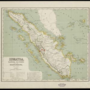
- check_box_outline_blankSumatra4
- check_box_outline_blankBelitung3
- check_box_outline_blankBanca2
- check_box_outline_blankBanka2
- check_box_outline_blankBilliton2
- check_box_outline_blankBorneo2
- check_box_outline_blankCentral Java2
- check_box_outline_blankEast Java2
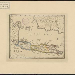
- check_box_outline_blankJava2
- check_box_outline_blankJava Sea2
- more Detailed Location »
Land Use
Land and Sea Routes
Cultural and Political Regions
Environmental Features
Insets and Attributes
Map Production Details
- check_box_outline_blankC.L. Brinkman2
- check_box_outline_blankGewestelijke Vereeniging Noord Holland van het Nederlandsch Onderwijzers-Genootschap2
- check_box_outline_blankMinisterie van Marine, Afdeeling Hydrographie2
- check_box_outline_blankRoeloffzen en Hübner2
- check_box_outline_blankSeyffardt's Boekhandel1


