Search

Search Results

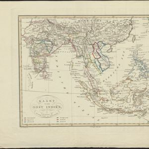
Kaart van Oost Indiën: behoorende bij Olivier Land- en zeetogten

event1830

location_onBrunei, Cambodia, East Timor, Indonesia, Laos, Malaysia, Myanmar, Philippines, Singapore, Southeast Asia, Thailand, Vietnam

Map from Johannes Olivier’s book ‘Land- en Zeetogten in Nederland's Indie [Land and Sea Journeys in the Dutch Indies]’, showing European colonial possessions and indigenous kingdoms in Asia.

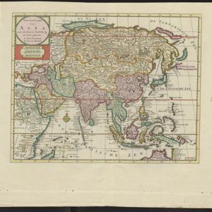
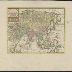
Nieuwe kaart van Asia na de alderlaatste ondekking int licht gebracht

event1733

location_onBrunei, Cambodia, East Timor, Indonesia, Laos, Malaysia, Myanmar, Papua New Guinea, Philippines, Singapore, Southeast Asia, Thailand, Vietnam

Map of Asia showing New Guinea (‘Nieuw Guinee’) and Australia (‘Nieuw Holland’) as one landmass, demonstrating that there was some uncertainty about the area’s geography in the early 18th century. However, it does include New Britain (‘N. Bretanje’).

Nieuwe kaart van Asia na de alderlaatste ondekking int licht gebracht

event1733

location_onBrunei, Cambodia, East Timor, Indonesia, Laos, Malaysia, Myanmar, Papua New Guinea, Singapore, Philippines, Southeast Asia, Thailand, Vietnam

Map of Asia showing New Guinea (‘Nieuw Guinee’) and Australia (‘Nieuw Holland’) as one landmass, demonstrating that there was some uncertainty about the area’s geography in the early 18th century. However, it does include New Britain (‘N. Bretanje’).

Nieuwe kaart van Asia na de alderlaatste ondekking int licht gebracht

event1733

location_onBrunei, Cambodia, East Timor, Indonesia, Laos, Malaysia, Myanmar, Papua New Guinea, Philippines, Singapore, Southeast Asia, Thailand, Vietnam

Map of Asia showing New Guinea (‘Nieuw Guinee’) and Australia (‘Nieuw Holland’) as one landmass, demonstrating that there was some uncertainty about the area’s geography in the early 18th century. However, it does include New Britain (‘N. Bretanje’).

Nieuwe kaart van Asia na de alderlaatste ondekking int licht gebracht

event1733

location_onBrunei, Cambodia, East Timor, Indonesia, Laos, Malaysia, Myanmar, Papua New Guinea, Singapore, Philippines, Southeast Asia, Thailand, Vietnam

Map of Asia showing New Guinea (‘Nieuw Guinee’) and Australia (‘Nieuw Holland’) as one landmass, demonstrating that there was some uncertainty about the area’s geography in the early 18th century. However, it does include New Britain (‘N. Bretanje’).

Nieuwe kaart van Asia na de alderlaatste ondekking int licht gebracht

event1733

location_onBrunei, Cambodia, East Timor, Indonesia, Laos, Malaysia, Myanmar, Papua New Guinea, Philippines, Singapore, Southeast Asia, Thailand, Vietnam

Map of Asia showing New Guinea (‘Nieuw Guinee’) and Australia (‘Nieuw Holland’) as one landmass, demonstrating that there was some uncertainty about the area’s geography in the early 18th century. However, it does include New Britain (‘N. Bretanje’).

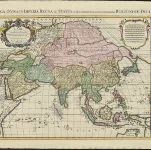
L'Asie divisée en ses principales regions, et ou se peuvent voir l'estendue des Empires, Monarchies, Royaumes, et Estats qui partagent présentement l'Asie

eventc.1700

location_onBrunei, Cambodia, East Timor, Indonesia, Laos, Malaysia, Myanmar, Papua New Guinea, Philippines, Singapore, Southeast Asia, Thailand, Vietnam

This map shows the empires, kingdoms and states of Southeast Asia. Its decorative cartouche features drawings of two women—one with a cornucopia and one with a censer (incense burner)—elephant heads, and a French coat of arms. Nine scales are shown.

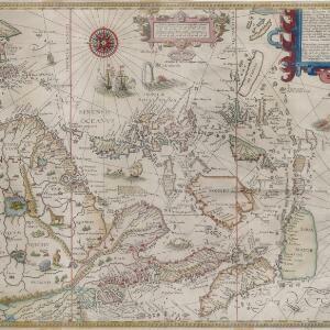
Exacta & accurata delineatio cùm orarum maritimarum tùm etiam locorum terrestrium quae in regionibus China, Cauchinchina, Camboia sive Champa, Syao, Malacca, Aracan & Pegu

event1596

location_onBrunei, Cambodia, East Timor, Indonesia, Laos, Malaysia, Myanmar, Philippines, Singapore, Southeast Asia, Thailand, Vietnam

Unusually, north is located to the left of this map of East Asia, rather than the top. The text notes that shallows and reefs are marked, and that the map is based on the explorations of Portuguese ships. Illustrations include sea monsters and ships.

close

  • Filter from 1596 to 1830

Current results range from 1596 to 1830