Search

Search Results

Westkust Borneo: Mond der Padang-Tikar rivier

event1884

location_onIndonesia

Navigation map of the mouth of the Padang Tikar River, on the west coast of Borneo, featuring bathymetric (water depth) routes. Obstructions are marked with letters: ‘m’ (mud), ‘z’ (sand). Trees, hills and fishermen’s houses are shown as landmarks.

Kaart van een gedeelte van Straat Soenda ter berekening van de hoeveelheid uitgeworpen stoffen

event1883

location_onIndonesia

A map showing the results of the 1883 eruption of the Krakatoa volcano. Black numbers indicate sea depth before the eruption; red numbers are after.

Handelskaartje van den Nederlandsch Indischen archipel

event1883

location_onIndonesia, East Timor

This map is concerned with trade in the Dutch East Indies, highlighting useful resources such as maritime routes, railways, telegraph lines and offices, coast and harbour lights, offices of officials, areas that apply tolls and duties etc.

New chart of Sunda Straits

event1883

location_onIndonesia

A map documenting the effects of the Krakatoa volcanic eruption, detailing the destruction of part of the Krakatoa Island and damage to surrounding areas. Created by a ship’s captain who passed through the Sunda Strait five days after the eruption.

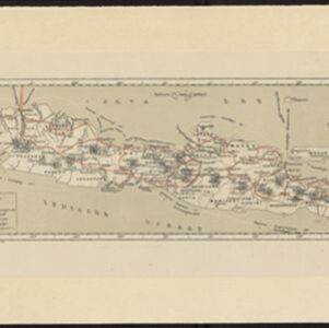
Kaart van Java

event1878

location_onIndonesia

Map of Java divided into administrative areas (‘residencies’). Telegraph lines, railways (including those under construction) and postal routes are marked. Around the coasts, the routes of steamships are shown, with journey distances in miles.

Kaart van Java

event1878

location_onIndonesia

Map of Java divided into administrative areas (‘residencies’). Telegraph lines, railways (including those under construction) and postal routes are marked. Around the coasts, the routes of steamships are shown, with journey distances in miles.

Schetskaart van de Reede van Analaboe en aangrenzende landstreek

event1877

location_onIndonesia

Hand-drawn map of the roadstead—a body of water sheltered from tides/currents, for ships to anchor—at Analaboe (Meulaboh) on the west coast of northern Sumatra. Bathymetry (sea depth), shoals and reefs, and an anchor point are marked.

Western part of the Java Sea : from Lucipara I. to Sunda Strait and Batavia

event1866

location_onIndonesia

Designed to aid navigation around the western Java Sea, this map features bathymetry (sea depth), current and tide data, and is marked with shoals, reefs and other hazards. Written notes add details at specific locations (e.g. ‘heavy tide rips’).

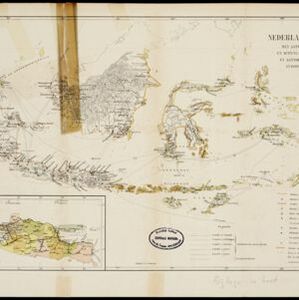
Nederlandsch Oost-Indië

event1865

location_onBrunei, Cambodia, East Timor, Indonesia, Laos, Malaysia, Myanmar, Vietnam, Thailand, Southeast Asia, Singapore, Philippines, Papua New Guinea

This detailed map of the Dutch East Indies in the mid-19th century contains a great deal of information: topographical details, settlements and administrative areas, roads, railways and maritime routes, telegraph lines, inset maps etc.

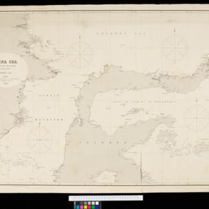
China Sea: Strait of Macassar to Celebes Sea

event1864

location_onIndonesia

Navigation map of the Celebes Sea, Makassar Strait and Java Sea, with bathymetry (sea depth), maritime routes, shoals and reefs, and landmark coastal mountains to aid navigation. On two sheets, which may not be from the same original map.

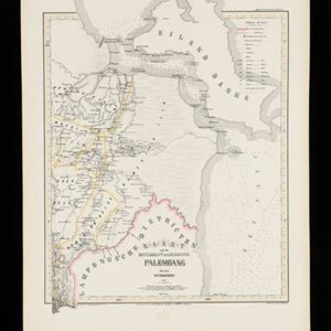
Kaart van de Oosterhelft der Residentie Palembang

event1860

location_onIndonesia

Map of the eastern half of the Dutch colonial administrative region (residency) of Palembang, Sumatra. A fort is marked in the town of Batoeradja. (From ‘Algemeene Atlas van Nederlandsche Indie [General Atlas of the Dutch East Indies]’.)

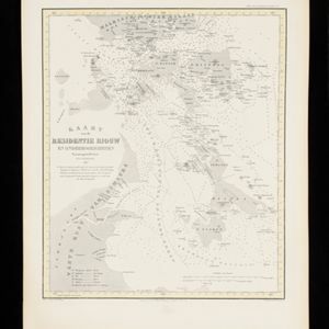
Kaart van de Residentie Riouw en Onderhoorigheden

event1860

location_onIndonesia, Singapore, Malaysia

Map of the Dutch colonial administrative region (residency) of Riouw (Riau) focusing on the islands and sea passages, with bathymetry (sea depth) marked. (From ‘Algemeene Atlas van Nederlandsche Indie [General Atlas of the Dutch East Indies]’.)

close