Search

Search Results

Kaart der residentie Soerakarta

event1859

location_onIndonesia

The residency of Soerakarta in Central Java is shown divided into regencies (yellow borders) and districts (blue borders). There is an inset plan of the capital city, Soerakarta (modern Surakarta), and mountains and land routes are marked.

Kaart van de Residentie Soerabaya

event1858

location_onIndonesia

Map of the Dutch colonial administrative region (residency) of Soerabaya (Surabaya, Java), including the Madura Strait and an inset map of the island of Bawean. (From ‘Algemeene Atlas van Nederlandsche Indie [General Atlas of the Dutch East Indies]’.

Kaart van de Residentie Djocjakarta

event1857

location_onIndonesia

Map of the Dutch colonial administrative region (residency) of Djocjakarta (Yogyakarta, Java), with its capital city of the same name at the centre. (From ‘Algemeene Atlas van Nederlandsche Indie [General Atlas of the Dutch East Indies]’.)

Reede van Bengkoelen

event1856

location_onIndonesia

Map of the bay at Bengkoelen (Bengkulu, west coast of Sumatra), with bathymetry (sea depth), islands, shoals and reefs marked. Two lighthouses are shown, with lines to indicate the limits of their range.

Reede van Bengkoelen

event1856

location_onIndonesia

Map of the bay at Bengkoelen (Bengkulu, west coast of Sumatra), with bathymetry (sea depth), islands, shoals and reefs marked. Two lighthouses are shown, with lines to indicate the limits of their range.

Kaart van het eiland Java

event1855

location_onIndonesia

Detailed map of Java based on the expeditions of the geologist and botanist Dr. Franz Junghuhn. There are 16 inset maps featuring volcanoes, mountains and coal seams.

Kaart van het eiland Java

event1855

location_onIndonesia

Detailed map of Java based on the expeditions of the geologist and botanist Dr. Franz Junghuhn. There are 16 inset maps featuring volcanoes, mountains and coal seams.

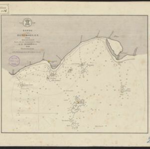
Kaart van de voornaamsten der Banda Eilanden

event1854

location_onIndonesia

Map of the Banda Islands, with a volcano on Goenong Api, two forts (‘Ft. Belgica’ and ‘Ft. Nassau’) on Neira, and a list of the heights of the mountains. (From ‘Algemeene Atlas van Nederlandsche Indie [General Atlas of the Dutch East Indies]’.)

Carte de l'ile de Java

eventc.1850

location_onIndonesia

Map of Java and Madura divided into administrative districts, and featuring mountains, settlements and major roads. There is an inset map of the port city of Batavia (Jakarta) and its surrounding fields and countryside.

Carte de l'ile de Java

eventc.1850

location_onIndonesia

Map of Java and Madura divided into administrative districts, and featuring mountains, settlements and major roads. There is an inset map of the port city of Batavia (Jakarta) and its surrounding fields and countryside.

General-Karte von Mittleren Sumatra von Padang bis Singkel

event1847

location_onIndonesia

This map focuses on the mountain ranges along the west coast of central Sumatra. Military bases, post offices, villages, rivers and hot springs are also marked, and there are inset maps of the towns of Padang and Singkel (Singkil).

Kaart van de Nederlandsche bezittingen in Oost-Indië

event1842

location_onBrunei, East Timor, Indonesia, Malaysia, Philippines, Singapore

This map shows the Dutch colonial possessions in the East Indies in the mid-19th century. Other country’s colonial territories are also shown: British (Malacca), Spanish (Philippines) and Portuguese (East Timor). Forts are also marked.

close