
Search Results


- Filter from 1650 to 1893
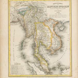
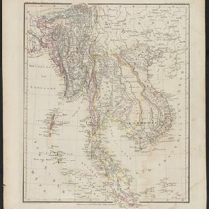
- [remove]Vietnam99
- Cambodia98
- Thailand98
- Malaysia97
- Indonesia90
- Singapore88
- Myanmar83
- Laos82
- Brunei81
- Philippines73
- Southeast Asia62
- East Timor61
- more Simple Location »
- [remove]Gulf of Thailand99
- Sumatra88
- Borneo79
- Malay Peninsula77
- Java65
- Sulawesi62
- Sunda Islands50
- Maluku Islands49
- Siam44
- Western New Guinea42
- South China Sea40
- Celebes38
- more Detailed Location »


