Search

Search Results

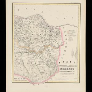
Kaart van de Oosterhelft der Residentie Rembang

event1858

location_onIndonesia

Map of the eastern half of the Dutch colonial administrative region (residency) of Rembang, Java. A sugar factory and tobacco establishment are marked. (From ‘Algemeene Atlas van Nederlandsche Indie [General Atlas of the Dutch East Indies]’.)

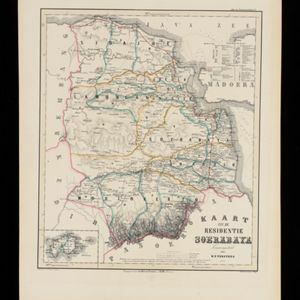
Kaart van de Residentie Soerabaya

event1858

location_onIndonesia

Map of the Dutch colonial administrative region (residency) of Soerabaya (Surabaya, Java), including the Madura Strait and an inset map of the island of Bawean. (From ‘Algemeene Atlas van Nederlandsche Indie [General Atlas of the Dutch East Indies]’.

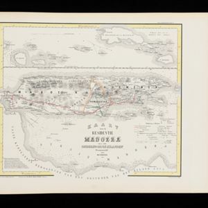
Kaart van de Residentie Madoera en Onderhoorige Eilanden

event1858

location_onIndonesia

Map of the Dutch colonial administrative region of the island of Madoera (Madura), featuring bathymetry (sea depth), and an inset map of the Kangean Islands. (From ‘Algemeene Atlas van Nederlandsche Indie [General Atlas of the Dutch East Indies]’.)
Asiatic archipelago

event1858

location_onVietnam, Myanmar, Papua New Guinea, Philippines, Singapore, Southeast Asia, Thailand, Malaysia, Laos, Indonesia, East Timor, Cambodia, Brunei

This late 19th century map of Southeast Asia shows the best maritime routes around the region, according to the time of year. There are also inset maps highlighting the rivers and southern islands of Singapore, and the sea depth around Labuan Island.

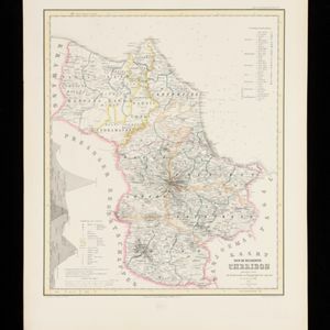
Kaart van de Residentie Cheribon

event1857

location_onIndonesia

Map of the Dutch colonial administrative region (residency) of Cheribon (Cirebon, Java), including an elevation showing the heights of the area’s mountains. (From ‘Algemeene Atlas van Nederlandsche Indie [General Atlas of the Dutch East Indies]’.)

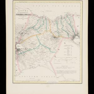
Kaart van de Residentie Probolinggo

event1856

location_onIndonesia

Map of the Dutch colonial administrative region (residency) of Probolinggo, Java, with an elevation showing the heights of the Tengger mountain range. (From ‘Algemeene Atlas van Nederlandsche Indie [General Atlas of the Dutch East Indies]’.)
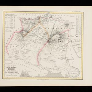
Kaart van de Residentie Bezoeki en de Afdeeling Banjoewangi

event1856

location_onIndonesia

Map of the Dutch colonial administrative regions of Bezoeki (Besuki) and Banjoewangi (Banyuwangi), on Java. Includes an elevation view of the mountains. (From ‘Algemeene Atlas van Nederlandsche Indie [General Atlas of the Dutch East Indies]’.)
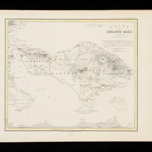
Kaart van het Eiland Bali

event1856

location_onIndonesia

Map of the Dutch colonial region of the island of Bali, featuring bathymetry (sea depth) in the Bali Strait, and an elevation showing heights of mountains. (From ‘Algemeene Atlas van Nederlandsche Indie [General Atlas of the Dutch East Indies]’.)
Algemeene Atlas van Nederlandsche Indie

eventc.1853-1862

location_onIndonesia

Atlas featuring over 60 detailed maps of the Dutch East Indies: 24 maps cover Java; the remainder cover the rest of the Dutch East Indies. There are three index maps. (All the maps in this atlas are also presented separately on this platform.)

Kaart der Residentie Batavia

event1853

location_onIndonesia

Map of the Dutch colonial administrative region (residency) of Batavia (Jakarta, Java). Batavia Bay has bathymetry (sea depth) and shipping routes. (From ‘Algemeene Atlas van Nederlandsche Indie [General Atlas of the Dutch East Indies]’.)
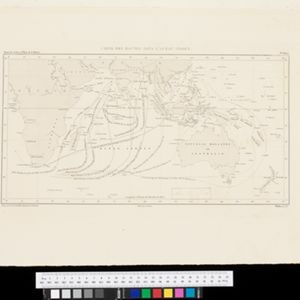
Carte des Routes dans l'Océan Indien

eventc.1849-1863

location_onBrunei, Cambodia, East Timor, Indonesia, Laos, Malaysia, Myanmar, Papua New Guinea, Philippines, Singapore, Southeast Asia, Thailand, Vietnam

Map of the Indian Ocean showing maritime routes, including some to and around Southeast Asia, where they pass through the Strait of Malacca, the Sunda Strait, and the straits between the Lesser Sunda Islands.

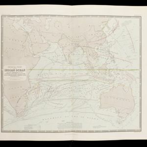
Physical chart of the Indian Ocean: shewing the temperature of the water, the currents of the air and ocean, directions of the wind, districts of hurricanes, regions of the monsoons & ty-foons, trade routes &c&c.

event1849

location_onBrunei, Cambodia, East Timor, Indonesia, Laos, Malaysia, Myanmar, Papua New Guinea, Philippines, Singapore, Southeast Asia, Thailand, Vietnam

Chart of the Indian Ocean, showing climate and weather-related data, including around the seas and straits of Southeast Asia where trade routes are marked, along with monsoon and typhoon regions, and currents during the different monsoon seasons.

close