Search

Search Results

Overzichtskaart van de Residentie Besoeki

event1899

location_onIndonesia

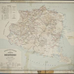
This map of the residency of Besoeki (Banyuwangi Regency, East Java) is divided into regencies and districts. Heights of mountains and settlements are given in metres, and distances are shown along roads. Sugar factories and fishing ponds are marked.

Plattegrond van het paleis van Z.E. den gouverneur generaal van Nederlandsch Indië te Buitenzorg

event1899

location_onIndonesia

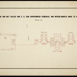
Floor plan of the palace of the Governor-General of the Dutch East Indies at Buitenzorg (Bogor, Java), now known as Bogor Palace. Although most official business was conducted in Batavia, Bogor was often preferred for its milder climate.

Stanford's Library Map of Asia

event1899

location_onBrunei, Cambodia, East Timor, Indonesia, Laos, Malaysia, Myanmar, Philippines, Singapore, Southeast Asia, Thailand, Vietnam

Southeast Asia is on sheet four of this map. British colonial territory—British Burma, the Straits Settlements, Sarawak, Brunei, British North Borneo—is highlighted in red, with Dutch, Spanish, French and Portuguese territory also shown.

Azie

eventc.1900

location_onBrunei, Cambodia, East Timor, Indonesia, Laos, Malaysia, Myanmar, Papua New Guinea, Philippines, Singapore, Southeast Asia, Thailand, Vietnam

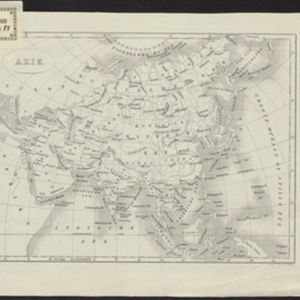
Dutch-language map of Asia, with mainland Southeast Asia labelled ‘Achter Indie [Beyond India]’.

Azie

eventc.1900

location_onBrunei, Cambodia, East Timor, Indonesia, Laos, Malaysia, Myanmar, Papua New Guinea, Philippines, Singapore, Southeast Asia, Thailand, Vietnam

Dutch-language map of Asia, with mainland Southeast Asia labelled ‘Achter Indie [Beyond India]’.

Commercial highways between United States and Asia and the islands of the Pacific

event1900

location_onBrunei, Cambodia, East Timor, Indonesia, Laos, Malaysia, Myanmar, Papua New Guinea, Philippines, Singapore, Southeast Asia, Thailand, Vietnam

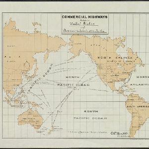
The United States Treasury Department produced this map of trade routes crossing the Pacific Ocean between the United States and Asia. Each route is labelled with the names of its ports, and with the distance between them in miles.

close