
Search


Refine your results
- Filter from 1599 to 1900
Current results range from 1599 to 1900
Location
- check_box[remove]Philippines17
- check_box_outline_blankIndonesia9
- check_box_outline_blankMalaysia9
- check_box_outline_blankVietnam8
- check_box_outline_blankBrunei6
- check_box_outline_blankCambodia6
- check_box_outline_blankEast Timor5
- check_box_outline_blankLaos5
- check_box_outline_blankSoutheast Asia5
- check_box_outline_blankThailand5
- check_box_outline_blankMyanmar4
- check_box_outline_blankSingapore4
- more Simple Location »
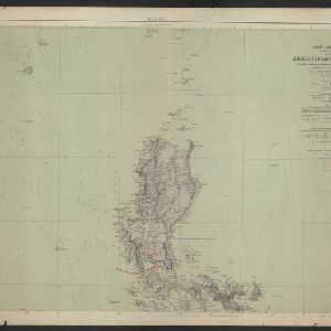
- check_box[remove]Luzon17
- check_box_outline_blankMindanao10
- check_box_outline_blankBorneo9
- check_box_outline_blankMindoro6
- check_box_outline_blankSouth China Sea6
- check_box_outline_blankSulu Sea6
- check_box_outline_blankCelebes5
- check_box_outline_blankLuconia5
- check_box_outline_blankManila5
- check_box_outline_blankPalawan5
- check_box_outline_blankSulawesi5
- check_box_outline_blankJava4
- more Detailed Location »
Land Use
- check_box_outline_blankCemetery/Columbarium1
- check_box_outline_blankChurch1
- check_box_outline_blankCourt of Law1
- check_box_outline_blankHospital1
- check_box_outline_blankMilitary Barracks1
- check_box_outline_blankPalace1
- check_box_outline_blankPolice Station1
- check_box_outline_blankPublic Space1
- check_box_outline_blankResidential Area1
Land and Sea Routes
Cultural and Political Regions
Environmental Features
Insets and Attributes
Map Production Details
- check_box_outline_blankBerghaus, Heinrich Karl Wilhelm4
- check_box_outline_blankAprès de Mannevillette, Jean-Baptiste d'2
- check_box_outline_blankJättnig, Wilhelm2
- check_box_outline_blankBry, Theodor de1
- check_box_outline_blankCamacho, Manuel M.1
- check_box_outline_blankClaesz, Cornelis1
- check_box_outline_blankDalrymple, Alexander1
- check_box_outline_blankThornton, John1
- check_box_outline_blankJustus Perthes4
- check_box_outline_blankDireccion de Hidrografia1
- check_box_outline_blankFort Dearborn Publishing Co.1
- check_box_outline_blankGeorge Philip & Son1
- check_box_outline_blankJames Imray & Son1
- check_box_outline_blankJohannes Loots1
- check_box_outline_blankJohannes van Keulen1
- check_box_outline_blankPhilippines Company1
- more Printer/Publisher »


