Search

Search Results

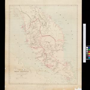
A Map of the Malay Peninsula

event1897

location_onIndonesia, Malaysia, Singapore, Thailand

On this late 19th century map of the Malay Peninsula, the British colonial territories—the Straits Settlements of Singapore, Malacca, Dinding and Penang—are in red, demarcating them from the British protectorate states of the rest of the peninsula.

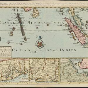
Partie de la nouvelle Grande Cartes des Indes Orientales, contenant les Isles Maldives, Ceylan, Malacca, Sumatra &c.

event1700

location_onIndonesia, Malaysia, Singapore, Thailand

Sumatra and the Malay Peninsula feature on this map of the Indian Ocean. Enganno Island, west of southern Sumatra, has a label that translates as ‘inhabited by very pernicious savages’. An inset map depicts the Madura Strait between Java and Madura.

close