Search

Search Results

L'Asie

event1669

location_onBrunei, Cambodia, East Timor, Indonesia, Laos, Malaysia, Myanmar, Philippines, Singapore, Southeast Asia, Thailand, Vietnam

Produced by the French cartographer Nicolas Sanson (1600–1667) in the mid-17th century, this map of Asia features hand-coloured regional borders. Its cartouche features cherubim and decorative scrollwork.

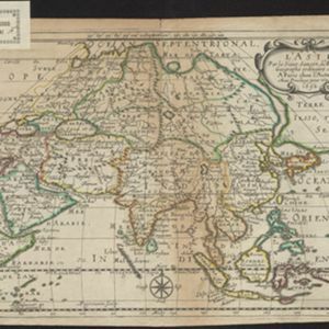
L'Asie

event1652

location_onBrunei, Cambodia, East Timor, Indonesia, Laos, Malaysia, Myanmar, Philippines, Singapore, Southeast Asia, Thailand, Vietnam

On this late 17th century map of Asia by the French cartographer Nicolas Sanson, mainland Southeast Asia is labelled ‘PresquIsle de la le Gange [Peninsula of the Ganges]’.

Les Isles Molvcqves; Celebes, Gilolo, &c.

event1652

location_onIndonesia, East Timor, Papua New Guinea

This map of the islands between Borneo and New Guinea features inset maps of the important spice trading islands (‘Spice Islands’): ‘Les Isles Molucques’ (Maluku Islands) and ‘Isles de Banda’ (Banda Islands).

Carta secon[d]a generale del'Asia

event1646

location_onIndonesia, East Timor, Philippines

This mid-17th century map of the Philippines, Celebes (Sulawasi), Maluku Islands and New Guinea has some inaccuracies, particularly in the shape of Celebes and New Guinea. However, the many Philippine islands are portrayed relatively accurately.

Asia: ex magna orbis terre descriptione Gerardi Mercatoris desumpta, studio & industria G.M. Iunioris

event1630

location_onBrunei, Cambodia, East Timor, Indonesia, Laos, Malaysia, Myanmar, Philippines, Singapore, Southeast Asia, Thailand, Vietnam

Originally published in Gerardus Mercator's ‘Atlas Sive Cosmographicae Meditationes de Fabrica Mundi et Fabricati Figura’ (1595), the title of which was the first use of the word ‘atlas’ to refer to a collection of maps. This is a 1630 reprint.

Insulæ Indiæ orientalis præcipuæ: in quibus Moluccæ celeberrimæ sunt

event1623

location_onBrunei, Cambodia, East Timor, Indonesia, Laos, Malaysia, Myanmar, Philippines, Singapore, Southeast Asia, Thailand, Vietnam

On the right of this map, Latin text held within an elaborate border notes that five of the Maluku Islands are located nearby—Ternate, Tidore, Moti, Makian and Bacan—which trade spices including clove, cinnamon, nutmeg and ginger to the world.

Tabula geograph in qua Europae, Africae, Asiaeq et circujacentium insularum orae maritimae accurate describuntur et ad jntelligentia navigationum Indicaru accommodantur

event1614

location_onBrunei, Cambodia, East Timor, Indonesia, Laos, Malaysia, Myanmar, Vietnam, Thailand, Southeast Asia, Singapore, Philippines

A map decorated with drawings of indigenous people, including from Southeast Asia: a Moluccan soldier with a helmet, sword and shield; a Javanese warrior with a spear and shield; a Sumatran woman holding a flower; and a Malaccan man with a sword.

Asiae nova descriptio

event1612

location_onBrunei, Cambodia, East Timor, Indonesia, Laos, Malaysia, Myanmar, Philippines, Singapore, Southeast Asia, Thailand, Vietnam

This early 17th century map features a number of mythical lakes that were once thought to exist in southern China—including ‘Cayamay Lacus’—and which feed several rivers that flow south through mainland Southeast Asia.

Insulæ Indiæ orientalis præcipuæ: in quibus Moluccæ celeberrimæ sunt

event1606

location_onBrunei, Cambodia, East Timor, Indonesia, Laos, Malaysia, Myanmar, Philippines, Singapore, Southeast Asia, Thailand, Vietnam

On the right of this map, Latin text held within an elaborate border notes that five of the Maluku Islands are located nearby—Ternate, Tidore, Moti, Makian and Bacan—which trade spices including clove, cinnamon, nutmeg and ginger to the world.

Indiae Orientalis insularumque adiacientium typus

event1598

location_onBrunei, Cambodia, East Timor, Indonesia, Laos, Malaysia, Myanmar, Philippines, Singapore, Southeast Asia, Thailand, Vietnam

A white banner at the right features text that notes that the ‘Insule Molucce’ (Maluku Islands) are famous for their abundance of spices, which are sold across the world. There are also Illustrations of mermaids and sea monsters wrecking a ship.

Asia

event1598

location_onBrunei, Cambodia, East Timor, Indonesia, Laos, Malaysia, Myanmar, Philippines, Singapore, Southeast Asia, Thailand, Vietnam

This late 16th century map features a 'wind-head', a decorative feature consisting of a drawing of the head of a human blowing to indicate wind.

close