
Search Results
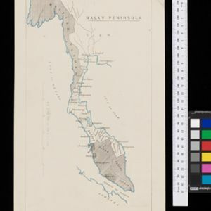

Map of the Malay Peninsula 1879
1879
Malaysia, Singapore, Thailand
Six-sheet map of the Malay Peninsula, featuring settlements, mountains and rivers. Labels note names of indigenous peoples, or describe terrain/resources. There is an inset map of Singapore town, and the Straits Settlements are highlighted in red.


Eastern Islands: Birmah &c.
1846
Brunei, Cambodia, East Timor, Indonesia, Laos, Malaysia, Myanmar, Philippines, Singapore, Southeast Asia, Thailand, Vietnam
On this map of Southeast Asia, British colonial territory is highlighted within red borders: the Straits Settlements (Singapore, Malacca and Penang) on the west coast of the Malay Peninsula; and British Burma (Chittagong and Aracan, and Tenasserim).

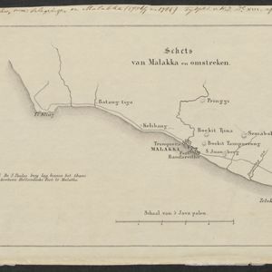
Kaart van de Nederlandsche bezittingen in Oost-Indië
1842
Brunei, East Timor, Indonesia, Malaysia, Philippines, Singapore
This map shows the Dutch colonial possessions in the East Indies in the mid-19th century. Other country’s colonial territories are also shown: British (Malacca), Spanish (Philippines) and Portuguese (East Timor). Forts are also marked.

Map of the countries between Bengal and China
1834
Indonesia, Malaysia, Thailand, Vietnam, Cambodia, Laos, Myanmar, Singapore
The location, size, and population (by ethnicity) of Pinang, Malacca and Singapore—the Straits Settlements—are listed, along with how/when they were acquired by Britain. The distances from Canton (China) to those cities, and to India, are also noted.


