
Search Results


Kaart van Nederlandsch-Indie
1893
Brunei, Cambodia, Indonesia, Malaysia, Singapore, Thailand, Vietnam, East Timor, Philippines, Southeast Asia
Shipping routes are the focus of this map of the Dutch East Indies, indicated by red lines labelled with the name of the shipping company and the destinations. Parcel shipping routes are also shown. Inset maps feature railway lines too.

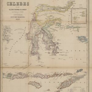
Kaart van den Nederlandsch-Indischen Archipel
1890
Indonesia, East Timor, Brunei, Cambodia, Malaysia, Philippines, Singapore, Southeast Asia, Thailand, Vietnam
The seas of the Dutch East Indies are the focus of this map, with maritime routes, sea temperature, sea depth, currents and monsoons shown. There are graphs of population by ethnicity, agriculture and livestock, trade and shipping, and trade exports.

Oost-Indie
c.1867
Brunei, Cambodia, East Timor, Indonesia, Laos, Malaysia, Myanmar, Philippines, Singapore, Southeast Asia, Thailand, Vietnam
Map of the East Indies in the mid-19th century, with Dutch colonial territory (Dutch East Indies) coloured in brown. Dutch administrative regions—such as residencies (‘residentie’) and governorates (‘gouvernement’)—are labelled.

Nederlandsche overzeesche bezittingen / Oost-Indië
1856
Brunei, East Timor, Indonesia, Malaysia, Singapore
Map of the East Indies, showing Dutch colonial territory (Dutch East Indies) in the mid-19th century. Coloured borders are used to highlight internal administrative regions. Three inset maps show other Dutch territories outside Southeast Asia.
- Filter from 1856 to 1898
- [remove]District/Administrative Border8
- Colonial Possessions5
- Civic/Metropolitan Border1


