Search

Search Results

Malay Archipelago, or East India Islands

event1851

location_onBrunei, Cambodia, East Timor, Indonesia, Laos, Malaysia, Myanmar, Papua New Guinea, Philippines, Singapore, Southeast Asia, Thailand, Vietnam

This mid-19th century map of Southeast Asia is illustrated with drawings of indigenous people from New Guinea, a ‘bee bear’ (probably a sun bear), a sailboat in front of Victoria Mount in New Guinea, and a village and palm trees in Sarawak, Borneo.

A chart of the Indian and Pacific Oceans with particular plans of the harbours

event1847

location_onBrunei, Cambodia, East Timor, Indonesia, Laos, Malaysia, Myanmar, Papua New Guinea, Philippines, Southeast Asia, Singapore, Thailand, Vietnam

Southeast Asia is shown on sheets two and three of this 12-sheet map of the Indian and Pacific oceans, including detailed inset maps of the straits of Singapore, Bangka, Gaspar and Sunda, with bathymetry (sea depth), shoals, reefs, anchorages etc.

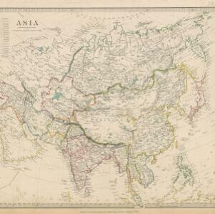
Asia / published under the superintendence of the Society for the Diffusion of Useful Knowledge

event1840

location_onBrunei, Cambodia, Indonesia, Laos, Malaysia, Myanmar, Philippines, Singapore, Southeast Asia, Vietnam, Thailand

This map of Asia was published by The Society for the Diffusion of Useful Knowledge in the mid-19th century. It includes a list of the number of people living in each Asian region, with the total population of Asia listed as 630 million.

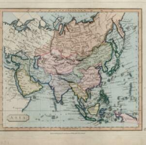
Asia

event1810

location_onBrunei, Cambodia, East Timor, Indonesia, Laos, Malaysia, Myanmar, Philippines, Singapore, Southeast Asia, Thailand, Vietnam

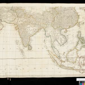
An early 19th century map of Asia by the English cartographer John Cary (c.1754–1835) with colour-coded regions.

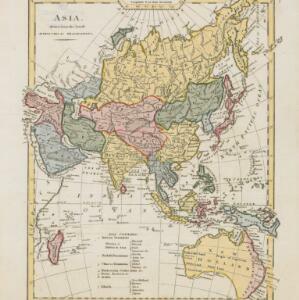
Asia: drawn from the latest astronomical observations

event1798

location_onBrunei, Cambodia, East Timor, Indonesia, Laos, Malaysia, Myanmar, Papua New Guinea, Philippines, Singapore, Southeast Asia, Thailand, Vietnam

This late 18th century map of Asia uses colour to differentiate various regions, with mainland Southeast Asia in blue, and maritime Southeast Asia in yellow, red, green and blue.

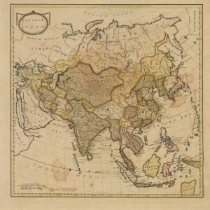
Asia / engraved for Walkers Geography &c.

event1792

location_onBrunei, Cambodia, East Timor, Indonesia, Laos, Malaysia, Myanmar, Papua New Guinea, Philippines, Singapore, Southeast Asia, Thailand, Vietnam

Hand-drawn coloured borders have been added to this map to distinguish various regions: mainland Southeast Asia and most of the islands of maritime Southeast Asia are bordered in green, with Borneo and the Philippines in red.

An Accurate Map of Asia

event1783

location_onBrunei, Cambodia, East Timor, Indonesia, Laos, Malaysia, Myanmar, Philippines, Singapore, Southeast Asia, Thailand, Vietnam

From the first volume of John Seally’s ‘A Complete Geographical Dictionary’, this map of Asia includes the ancient kingdoms of mainland Southeast Asia, and the Sunda and Molucca islands (‘Molucca or Spice Islands’) of maritime Southeast Asia.

Present Asia

event1783

location_onVietnam, Myanmar, Philippines, Singapore, Southeast Asia, Thailand, Malaysia, Laos, Indonesia, East Timor, Cambodia, Brunei

Coloured borders divide this late 18th century map of Asia into empires, kingdoms and regions. Five major rivers that flow south through mainland Southeast Asia are named: Aua, Pegu, Tenasserim, Menan and Camboya.

Asia: according to the Sieur D'Anville, divided into its Empires, Kingdoms & States

event1780

location_onBrunei, Cambodia, East Timor, Indonesia, Laos, Malaysia, Myanmar, Papua New Guinea, Philippines, Singapore, Southeast Asia, Thailand, Vietnam

The cartouche on this map of Asia features an Asian man smoking a long pipe, surrounded by packages, vases, a bow and arrow, a censer (incense burner) and a camel carrying a large load. The second sheet of the map features Southeast Asia.

The principal islands of the East-Indies: explaining what belongs to England, Spain and Holland &c.

event1732

location_onBrunei, Cambodia, East Timor, Indonesia, Philippines, Malaysia, Thailand, Vietnam, Singapore, Southeast Asia

The letters ‘E’ or ‘D’ are marked after place names to indicate if they are English or Dutch colonial possessions: e.g. ‘Marleborough Fort E’ on Sumatra or ‘Concordia Fort D’ on Timor. The Philippines are labelled ‘to Spain’.

To the Right Honourable William, Lord Cowper, Lord High Chancellor of Great Britain, this map of Asia

event1720

location_onBrunei, Cambodia, East Timor, Indonesia, Laos, Malaysia, Myanmar, Papua New Guinea, Philippines, Singapore, Southeast Asia, Thailand, Vietnam

Map dedicated to William Cowper, whose coat of arms sits atop the cartouche. It features two horses holding a crest with three martlets (mythical birds used in heraldry). The cartouche also features Asian traders. Monsoons are marked on the map.

To the Right Honourable William, Lord Cowper, Lord High Chancellor of Great Britain, this map of Asia

eventc.1715

location_onVietnam, Myanmar, Papua New Guinea, Philippines, Singapore, Southeast Asia, Thailand, Malaysia, Laos, Indonesia, East Timor, Cambodia, Brunei

The arrows on this map show the direction of the seasonal monsoons: each arrow has a label, indicating the month. The northeast coast of Borneo is labelled ‘A Desart [desert/deserted?] Coast’, while the south is labelled ‘Pepper Country’.

close