Search

Search Results

Route chart to India and the East

event1895

location_onBrunei, Cambodia, East Timor, Indonesia, Laos, Malaysia, Myanmar, Philippines, Singapore, Southeast Asia, Thailand, Vietnam

Map of Asia featuring steamship routes—including around Southeast Asia—connecting ports such as Penang, Singapore, Batavia (Jakarta), Saigon, Bangkok, Rangun (Yangon), Manila, Macassar (Makassar) etc. There is also an inset map of Singapore.

Trade Routes in the Far East

event1894

location_onBrunei, Cambodia, Indonesia, Laos, Malaysia, Myanmar, Philippines, Singapore, Thailand, Vietnam

Map of stream ship trade routes around Southeast Asia. Rivers, railways, submarine telegraph cables, lighthouses (fixed, revolving and flashing), graving docks and coaling stations are marked. An inset map shows a railway route from Britain to Asia.

Océan Indien

event1889

location_onBrunei, Cambodia, East Timor, Indonesia, Laos, Malaysia, Myanmar, Philippines, Singapore, Southeast Asia, Thailand, Vietnam

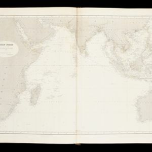
A nautical chart of the Indian Ocean showing bathymetry (sea depth), including in great detail around the seas and straits of Southeast Asia.

Carte des Routes dans l'Océan Indien

eventc.1849-1863

location_onBrunei, Cambodia, East Timor, Indonesia, Laos, Malaysia, Myanmar, Papua New Guinea, Philippines, Singapore, Southeast Asia, Thailand, Vietnam

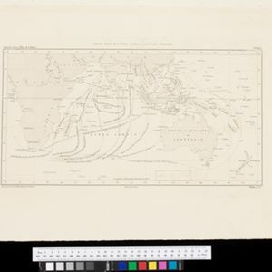
Map of the Indian Ocean showing maritime routes, including some to and around Southeast Asia, where they pass through the Strait of Malacca, the Sunda Strait, and the straits between the Lesser Sunda Islands.

A chart of the Indian and Pacific Oceans with particular plans of the harbours

event1847

location_onBrunei, Cambodia, East Timor, Indonesia, Laos, Malaysia, Myanmar, Papua New Guinea, Philippines, Southeast Asia, Singapore, Thailand, Vietnam

Southeast Asia is shown on sheets two and three of this 12-sheet map of the Indian and Pacific oceans, including detailed inset maps of the straits of Singapore, Bangka, Gaspar and Sunda, with bathymetry (sea depth), shoals, reefs, anchorages etc.

The continent and islands of Asia: with all the latest discoveries

event1809

location_onVietnam, Myanmar, Papua New Guinea, Philippines, Singapore, Southeast Asia, Thailand, Malaysia, Laos, Indonesia, East Timor, Cambodia, Brunei

Southeast Asia is on the last sheet of this map of Asia. The South China Sea is labelled ‘Malayan Sea’. Small islands, shoals and reefs are shown. A label in Cochin China (Vietnam) reads ‘mountains inhabited by the uncivilized people called Kemoys’.

Chart of East Indian Islands exhibiting the several Passages between the Indian and Pacific Oceans

event1800

location_onBrunei, Cambodia, East Timor, Indonesia, Laos, Malaysia, Myanmar, Philippines, Singapore, Southeast Asia, Thailand, Vietnam

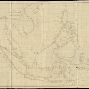
Map focusing on the passages between the islands of maritime Southeast Asia. Many 18th century routes are labelled with the ship/captain’s name and date, and there are notes on some shoals and reefs recording names, details and incidents/shipwrecks.

Carte réduite du Golfe de Bengale, depuis l'isle de Ceylan jusqu'au Golfe de Siam, avec la partie septentrionale du détroit de Malac

event1775

location_onMyanmar, Thailand, Cambodia, Malaysia, Indonesia

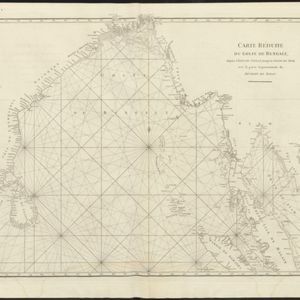
Map of the Bay of Bengal, with the western coast of mainland Southeast Asia. Shoals, reefs and islands are marked. The web of lines is a rhumbline network, while the numbers indicate sea depth (bathymetry), both used to aid navigation.

Deese wassende pas-kaart van Oost-Indien, is nu te bekoomen voor die deselve begeeren

eventc.1728-1738

location_onBrunei, Cambodia, East Timor, Indonesia, Laos, Malaysia, Myanmar, Papua New Guinea, Philippines, Singapore, Southeast Asia, Thailand, Vietnam

Map of the Indian Ocean dominated by a rhumbline network—a web of interconnected lines used to help plot routes—with a compass rose at the centre. At the top there are (incomplete) drawings of people with text in Dutch, French, English and Spanish.

[Portolan chart of the South China Sea]

event1701

location_onBrunei, Cambodia, Indonesia, Laos, Malaysia, Philippines, Thailand, Vietnam

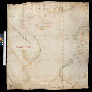
Hand-drawn portolan (nautical) chart, featuring a rhumbline network (the web of interconnected lines), bathymetry (sea depth), shoals and reefs, names of coastal settlements, and an elevation (side view) of a mountain at the north tip of Borneo.

close