
Search Results


Oostkust Sumatra. Schetskaart der Siak Rivier van het Eiland Tengah tot Siak
1894
Indonesia
This late 19th century large-scale (1:30,000) map show just a section of the Siak River, in the Riau province of Sumatra. Bathymetry (water depth) is shown in figures to aid navigation, with various landmarks noted along the river’s banks.

Kaart van Nederlandsch-Indie
1893
Brunei, Cambodia, Indonesia, Malaysia, Singapore, Thailand, Vietnam, East Timor, Philippines, Southeast Asia
Shipping routes are the focus of this map of the Dutch East Indies, indicated by red lines labelled with the name of the shipping company and the destinations. Parcel shipping routes are also shown. Inset maps feature railway lines too.

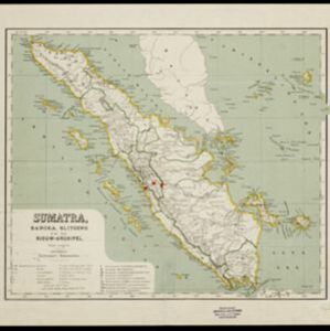
Kaart van het middengedeelte van Sumatra
1890
Indonesia
Details of each area’s resources are printed on this map of Sumatra: rattan, coffee, pepper, Chinese cinnamon, tobacco, resins, camphor, cotton, coal, gold, lumber, elephants, horses, as well as the locals’ ethnicity (Malays, Javanese, Acehnese).

Kaart van den Nederlandsch-Indischen Archipel
1890
Indonesia, East Timor, Brunei, Cambodia, Malaysia, Philippines, Singapore, Southeast Asia, Thailand, Vietnam
The seas of the Dutch East Indies are the focus of this map, with maritime routes, sea temperature, sea depth, currents and monsoons shown. There are graphs of population by ethnicity, agriculture and livestock, trade and shipping, and trade exports.

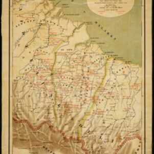
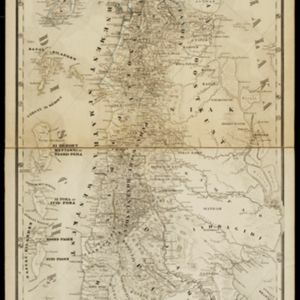
Het stroomgebied van Bila en Pane: Opgenomen en in kaart gebracht... gedurende de jaren 1876, 1877, 1878, 1882, 1883, 1884
1885
Indonesia
A map of the watershed of the Bila and Pane rivers in northern Sumatra. In addition to many rivers/tributaries, mountains, roads, paths and administrative borders are marked. Side views of mountains (elevations) are shown to use a landmarks.
Kaart van een gedeelte der Oostkust van Sumatra (Langkat, Deli en Serdang) waar tabaks-plantingen zijn
1884
Indonesia
Map of tobacco plantations in three regencies on the east coast of Sumatra. Each plantation is marked in red with the name of the brand under which its tobacco is imported into the Netherlands. Roads, railways and rivers are also shown.

- Filter from 1596 to 1899
- Indonesia186
- Malaysia145
- Singapore145
- Brunei141
- Thailand136
- Cambodia133
- Philippines131
- Vietnam127
- Myanmar120
- Laos119
- East Timor112
- Southeast Asia112
- more Simple Location »
- [remove]Sumatra186
- Borneo147
- Java143
- Malay Peninsula119
- Sulawesi115
- Celebes91
- Siam82
- Pegu80
- Western New Guinea76
- Malacca73
- Iava51
- East Indies46
- more Detailed Location »


