Search Results

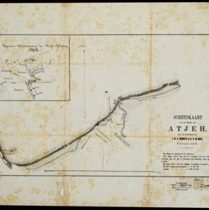
[Schetskaarten van versterkingen, loopgraven, stellingen, bentengs e.d. uit de Atjeh oorlog]
1880
Indonesia
Multiple maps from the Aceh War, spread over 12 sheets. Includes maps of fortifications, trenches, battle formations; building plans, including the Aceh Sultan’s palace; topographic maps; and drawings of a ‘kotta mara’ (fortified raft).

Tocht van de expeditie kolonne over Seglie naar Telok Kadjoe van 6-24 Mei 1878
1879
Indonesia
Map of a Dutch military expedition from Seglie (Sigli) on the northeast coast of Sumatra to Telok Kadjoe, during the Aceh War between Aceh and Dutch colonists. They land at Sigli and cross marshland, high grass, and rice and sugarcane fields.

Algemeene kaart van Nederlandsch Indië
1879
Cambodia, Indonesia, Papua New Guinea, East Timor, Southeast Asia, Thailand, Malaysia, Philippines, Laos, Vietnam, Singapore, Brunei, Myanmar
A late 19th century map of the Dutch East Indies on four sheets, detailing maritime routes around the region. There are also inset maps showing railways, rivers, roads, and telegraph systems, as well as individual islands and cities.

Situatie kaart van een gedeelte der stad Batavia
1874
Indonesia
Map of the coastline of the bay of Batavia (Jakarta) showing the extension of the port’s pier (in red, labelled CD), the sand and mud bank and bathymetry (sea depth) in the bay, and notes regarding changes in tide levels over the years.
- Filter from 1547 to 1899
- [remove]Indonesia183
- Malaysia32
- East Timor31
- Singapore31
- Brunei26
- Philippines26
- Thailand24
- Cambodia23
- Vietnam23
- Southeast Asia21
- Laos20
- Myanmar20
- more Simple Location »
- [remove]Military Fort183
- Residential Area76
- Kampong/Village68
- Church54
- Cemetery/Columbarium49
- Hospital45
- Military Barracks45
- Public Space44
- Post Office26
- Temple24
- Palace21
- Mosque17
- Well15
- Jail/Prison14
- more Settlement Features »


