Search

Search Results

[Various Indonesian islands]

eventc.1900

location_onMalaysia, Brunei, Indonesia, Singapore

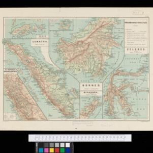
Seven locations in the Dutch East Indies on one sheet: the islands of Borneo, Sumatra, Celebes (Sulawesi), Ambon and Banda, the city of Padang and its region on the west coast of Sumatra, and the tip of the Minahasa Peninsula (northern Celebes).

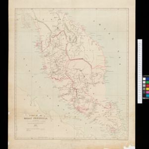
A Map of the Malay Peninsula

event1897

location_onIndonesia, Malaysia, Singapore, Thailand

On this late 19th century map of the Malay Peninsula, the British colonial territories—the Straits Settlements of Singapore, Malacca, Dinding and Penang—are in red, demarcating them from the British protectorate states of the rest of the peninsula.

Soematra, Bangka en de Riouw-Lingga Archipel

event1897

location_onMalaysia, Indonesia, Singapore, Myanmar

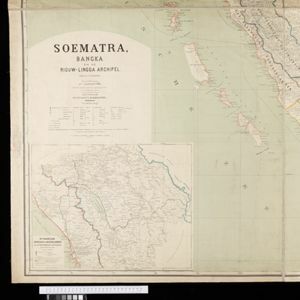
Map of Sumatra and surrounding islands, with residencies—administrative districts—shown by coloured borders. There are inset maps of two residencies surrounding Padang, and of Groot-Atjeh (Aceh). Rivers, railways, roads and settlements are marked.

Kaart van een gedeelte van Borneo: met aanwijzing van de grens tusschen het Nederlandsch gebied en dat van het Britsche Protectoraat

event1891

location_onIndonesia, Malaysia, Myanmar

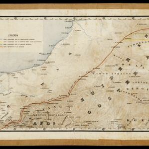
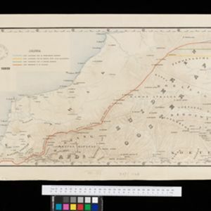
Map marking the border (in orange) agreed between British and Dutch territory on Borneo in 1891. Alternative borders are shown: according to the Dutch (blue), according to the British North Borneo Society (yellow) and proposed by the British (green).

Kaart van een gedeelte van Borneo: met aanwijzing van de grens tusschen het Nederlandsch gebied en dat van het Britsche Protectoraat

event1891

location_onIndonesia, Malaysia

Map marking the border (in orange) agreed between British and Dutch territory on Borneo in 1891. Alternative borders are shown: according to the Dutch (blue), according to the British North Borneo Society (yellow) and proposed by the British (green).

India, Burmah and the adjacent parts of Beluchistan, Afghanistan, Turkestan, the Chinese Empire, and Siam

event1887

location_onMyanmar, Thailand, Malaysia, Indonesia

British Burma is shown on the right of this two-sheet map of India. The green areas had come under British rule after the first and second Anglo-Burmese wars, with Upper Burma (light brown) being incorporated after the Third Anglo-Burmese War (1885).

Kaart der residentie Riouw met onderhoorigheden, aangrenzend deel van Sumatra's Westkust en schiereiland Malakka

event1871

location_onIndonesia, Malaysia, Singapore

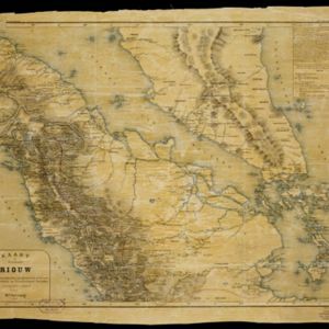
Map of the Riouw (Riau) Residency, Sumatra. The border between Riau and the island’s west coast is marked in red ‘as far as it is known [voor zoo verre die... bekend is]’, ending abruptly in the unexplored mountains near Lake Toba, northern Sumatra.

Nederlandsch Oost-Indië

event1865

location_onBrunei, Cambodia, East Timor, Indonesia, Laos, Malaysia, Myanmar, Vietnam, Thailand, Southeast Asia, Singapore, Philippines, Papua New Guinea

This detailed map of the Dutch East Indies in the mid-19th century contains a great deal of information: topographical details, settlements and administrative areas, roads, railways and maritime routes, telegraph lines, inset maps etc.

Nederlandsch Oost-Indië

event1840

location_onBrunei, East Timor, Indonesia, Malaysia, Papua New Guinea, Philippines, Singapore

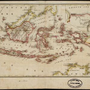
The Dutch East Indies are bordered in red on this mid-19th century map. A maritime postal route from China to Europe, via Singapore and Penang, is shown. Another maritime route, from Batavia to Singapore, is also marked.

Eastern islands or Malay archipelago

event1836

location_onBrunei, Cambodia, East Timor, Indonesia, Laos, Malaysia, Myanmar, Philippines, Singapore, Southeast Asia, Vietnam, Thailand

Brief notes printed on this 19th century map of Southeast Asia provide details about each region, including: numbers and ethnicity of the population, local or colonial rulers, crops and products, geography (corals, forests, volcanos, earthquakes).

Partie de la nouvelle Grande Cartes des Indes Orientales, contenant les Isles Maldives, Ceylan, Malacca, Sumatra &c.

event1700

location_onIndonesia, Malaysia, Singapore, Thailand

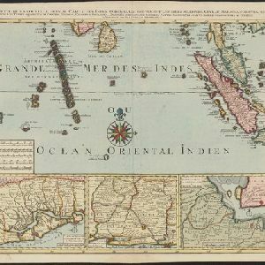
Sumatra and the Malay Peninsula feature on this map of the Indian Ocean. Enganno Island, west of southern Sumatra, has a label that translates as ‘inhabited by very pernicious savages’. An inset map depicts the Madura Strait between Java and Madura.

Isole dell'Indie divise in Filippine, Molucche e della Sonda

eventc.1691-1696

location_onBrunei, Cambodia, East Timor, Indonesia, Laos, Malaysia, Myanmar, Philippines, Singapore, Southeast Asia, Thailand, Vietnam

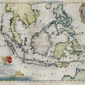
Dotted lines and colours divide maritime Southeast Asia into three regions on this map: the Philippine archipelago, Maluku Islands and Sunda Islands. The cartouche features cherub mermaids carrying a banner and shield.

close