Search

Search Results

Map to illustrate Convention of March 1st 1894 between Great Britain and China: From the Map of Upper Burma

event1894

location_onMyanmar

Map of the border region between the Shan States of northeast Burma (Myanmar) and China's Yunnan Province, illustrating the result of the 1894 Sino-British boundary convention. The Burma side is more detailed, with mountains, rivers and settlements.

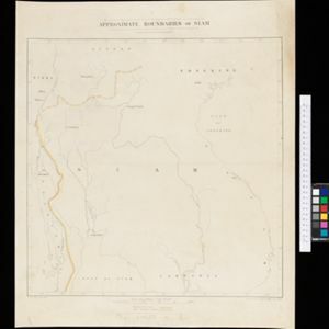
Facsimile of map given to the French Ambassador 29th Aug. 1889 as indicating the Approximate Boundaries of Siam to the North West & North such as they have hitherto been considered

event1893

location_onCambodia, Laos, Myanmar, Thailand, Vietnam

The border between Siam (Thailand) and Tenasserin (Tanintharyi Region, Myanmar) is highlighted on this map, while the more northerly border between Siam and Burma (Myanmar) is marked as being ‘approximate’.

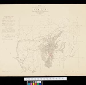
Map to show lines of advance on Manipur

event1891

location_onMyanmar

Map of three routes taken by British troops through the mountains to the Indian city of Manipur (Imphal) during the Anglo-Manipur War of 1891. The map includes part of Burma to the east.

close

  • Filter from 1891 to 1894

Current results range from 1891 to 1894