Search

Search Results

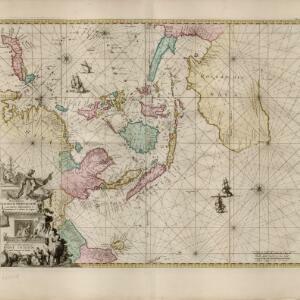
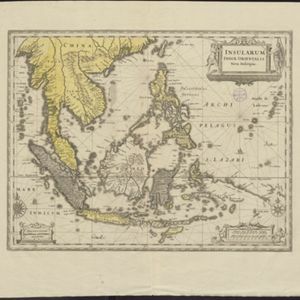
Tabula Indiæ Orientalis et regnorum adjacentium

event1724

location_onBrunei, Cambodia, East Timor, Indonesia, Laos, Malaysia, Myanmar, Philippines, Singapore, Southeast Asia, Thailand, Vietnam

Colourful map of the East Indies focusing on maritime navigation: there is a compass rose at the centre of a rhumbline network (a web of lines to help plot routes). Shoals, reefs and islands are also marked.

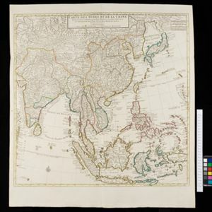
Carte des Indes et de la Chine

eventc.1722-1774

location_onBrunei, Cambodia, East Timor, Indonesia, Laos, Malaysia, Myanmar, Philippines, Singapore, Southeast Asia, Thailand, Vietnam

This map uses coloured borders to show the ancient kingdoms of Southeast Asia. A label on the island of Borneo states ‘Beajous Idolatres habitans le milieu de l'Isle [Beajous idolaters inhabit the middle of the Island]’.

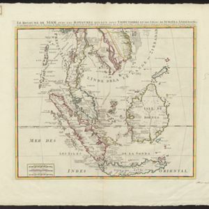
Le Royaume de Siam avec les Royaumes qui luy sont Tributaires et les Isles de Sumatra, Andemaon etc.

event1719

location_onBrunei, Cambodia, Indonesia, Laos, Malaysia, Myanmar, Singapore, Thailand, Vietnam

Map of part of Southeast Asia, featuring a maritime route from the Sunda Strait to the ports of Bantam (Banten) and Batavia (Jakarta) on Java, and then up through the Gulf of Thailand to the Kingdom of Siam. The return route is also marked.

Orientaliora Indiarum Orientalium cum insulis adjacentibus à promontorio C. Comorin ad Iapan = Pascaert van t'Ooster gedeelte van Oost Indien van C. Comorin tot Iapan

event1715

location_onBrunei, Cambodia, East Timor, Indonesia, Laos, Malaysia, Myanmar, Philippines, Singapore, Southeast Asia, Thailand, Vietnam

The cartouche on this early 18th century navigation map features the title in Latin and Dutch, as well as a wealth of detailed drawings illustrating the region’s trade: Asian merchants, their goods and animals, and two female European customers.

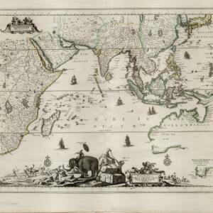
Nova tabvla India Orientalis

eventc.1702-1705

location_onBrunei, Cambodia, East Timor, Indonesia, Laos, Malaysia, Myanmar, Philippines, Singapore, Southeast Asia, Thailand, Vietnam

An early 18th century map of the Indian Ocean, illustrated with a drawing of Asian merchants riding an elephant and using a camel to transport their goods. Other men use bows and arrows to hunt ostriches. Ships are also shown sailing on the ocean.

Carte des Indes et de la Chine

eventc.1700

location_onBrunei, Cambodia, East Timor, Indonesia, Laos, Malaysia, Myanmar, Philippines, Singapore, Southeast Asia, Thailand, Vietnam

The regional borders of early 18th century Southeast Asia are shown on this map. Mountains are shown pictorially, and larger settlements are marked with a building symbol. Southern Borneo is labelled ‘Pays des Mahometans [Land of the Muslims]’.

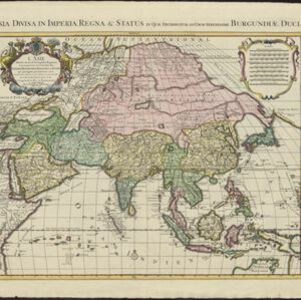
L'Asie divisée en ses principales regions, et ou se peuvent voir l'estendue des Empires, Monarchies, Royaumes, et Estats qui partagent présentement l'Asie

eventc.1700

location_onBrunei, Cambodia, East Timor, Indonesia, Laos, Malaysia, Myanmar, Papua New Guinea, Philippines, Singapore, Southeast Asia, Thailand, Vietnam

This map shows the empires, kingdoms and states of Southeast Asia. Its decorative cartouche features drawings of two women—one with a cornucopia and one with a censer (incense burner)—elephant heads, and a French coat of arms. Nine scales are shown.

Insularum Indiæ orientalis nova descriptio

eventc.1700

location_onBrunei, Cambodia, East Timor, Indonesia, Laos, Malaysia, Myanmar, Philippines, Singapore, Southeast Asia, Thailand, Vietnam

The outline of the island of New Guinea is very vague on this early 17th century map of Southeast Asia. The cartouche is decorated with two figures of Asian warriors: one holds a spear, the other a sword. There are also drawings of mermaids.

Inde orientale

eventc.1700-1799

location_onBrunei, Cambodia, Indonesia, Laos, Malaysia, Myanmar, Philippines, Thailand, Vietnam

Four long rivers flow south through mainland Southeast Asia on this map: the ‘Menan’, ‘Manthabam’ and ‘Cosmin’ originate at a mythical lake (‘Chiamai Lac’) in southern China, while the ‘Mecon’ (Mekong) flows from the hills of Cochinchina (Vietnam).

close