Search

Search Results

Route chart to India and the East

event1895

location_onBrunei, Cambodia, East Timor, Indonesia, Laos, Malaysia, Myanmar, Philippines, Singapore, Southeast Asia, Thailand, Vietnam

Map of Asia featuring steamship routes—including around Southeast Asia—connecting ports such as Penang, Singapore, Batavia (Jakarta), Saigon, Bangkok, Rangun (Yangon), Manila, Macassar (Makassar) etc. There is also an inset map of Singapore.

Plan of the town and suburbs of Rangoon

eventc.1895-1897

location_onMyanmar

Detailed plan of the city of Rangoon (Yangon, Myanmar) with commercial, religious, government and military buildings, surrounded by lakes, fields of crops and villages. Someone has drawn details on the map of areas that have undergone ‘levelling’.

Trade Routes in the Far East

event1894

location_onBrunei, Cambodia, Indonesia, Laos, Malaysia, Myanmar, Philippines, Singapore, Thailand, Vietnam

Map of stream ship trade routes around Southeast Asia. Rivers, railways, submarine telegraph cables, lighthouses (fixed, revolving and flashing), graving docks and coaling stations are marked. An inset map shows a railway route from Britain to Asia.

Military cantonments: town and suburbs of Akyab, 1853-54

event1866

location_onMyanmar

Plan of British military installations in the port town of Akyab, Burma (Sittwe, Myanmar), featuring piers on the Kolladyne River (Kaladan River), hospitals, a work house, mission house, hotel, bazaar, burial grounds, religious buildings etc.

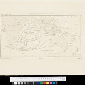
Carte des Routes dans l'Océan Indien

eventc.1849-1863

location_onBrunei, Cambodia, East Timor, Indonesia, Laos, Malaysia, Myanmar, Papua New Guinea, Philippines, Singapore, Southeast Asia, Thailand, Vietnam

Map of the Indian Ocean showing maritime routes, including some to and around Southeast Asia, where they pass through the Strait of Malacca, the Sunda Strait, and the straits between the Lesser Sunda Islands.

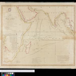
Chart... Shewing the Connection and respective distances by Sea, between the principal harbours and Settlements in the East Indies

event1794

location_onThailand, Myanmar, Malaysia, Indonesia

Maritime routes had to be adjusted in response to the changing monsoon seasons, as is seen on this late 18th century map of the Indian Ocean. Drawings of the heads of children blowing—called ‘wind-heads’—are used to indicate wind direction.

A map of the East-Indies and the adjacent countries: with the settlements, factories and territories, explaning what belongs to England, Spain, France, Holland, Denmark, Portugal &c.

event1720

location_onBrunei, Cambodia, East Timor, Indonesia, Laos, Malaysia, Myanmar, Philippines, Vietnam, Thailand, Southeast Asia, Singapore

This map showcases the colonial territories of Southeast Asia in the 18th century, with text detailing trading information and the products of each region. There are five inset maps featuring plans of specific trading ports.

close

  • Filter from 1720 to 1895

Current results range from 1720 to 1895