location_onBrunei, Cambodia, East Timor, Indonesia, Laos, Malaysia, Myanmar, Philippines, Singapore, Southeast Asia, Thailand, Vietnam
[Philippine Islands]
event1665
location_onPhilippines
[Map of the East Indies]
event1666
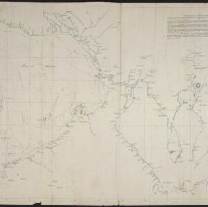
location_onVietnam, Myanmar, Papua New Guinea, Philippines, Singapore, Southeast Asia, Thailand, Malaysia, Laos, Indonesia, East Timor, Cambodia, Brunei
[Portolan chart of the South China Sea]
event1701
location_onBrunei, Cambodia, Indonesia, Laos, Malaysia, Philippines, Thailand, Vietnam
Chart of the China Sea
event1746
location_onBrunei, Cambodia, Indonesia, Malaysia, Philippines, Vietnam
Suite du plan contenant depuis Camboya, Cochinchine jusques à Canton avec les Isles Aimant et Philipines
eventc.1750
location_onCambodia, Philippines, Vietnam
A dangerous shoal seen Septr. the 28, 1767 (Joseph Freewills Islands)
event1773
location_onPhilippines, Indonesia
A new chart of the Oriental Seas and Islands... from the Isle of Ceylon to Amoye in China
event1790
location_onBrunei, Cambodia, East Timor, Indonesia, Laos, Malaysia, Myanmar, Philippines, Singapore, Southeast Asia, Thailand, Vietnam
Chart of East Indian Islands exhibiting the several Passages between the Indian and Pacific Oceans
event1800
location_onBrunei, Cambodia, East Timor, Indonesia, Laos, Malaysia, Myanmar, Philippines, Singapore, Southeast Asia, Thailand, Vietnam
Chart of East Indian Islands exhibiting the several Passages between the Indian and Pacific Oceans
event1800
location_onBrunei, Cambodia, East Timor, Indonesia, Laos, Malaysia, Myanmar, Philippines, Singapore, Southeast Asia, Thailand, Vietnam
[Manuscript map of Manila Harbor and Bay Lake]
event1810
location_onPhilippines
Chart of the East India Islands: exhibiting the several passages between the Indian and Pacific Oceans
event1824
location_onBrunei, Cambodia, East Timor, Indonesia, Malaysia, Philippines, Singapore, Thailand, Vietnam, Southeast Asia, Myanmar