Search

Search Results

[Various Indonesian islands]

eventc.1900

location_onMalaysia, Brunei, Indonesia, Singapore

Seven locations in the Dutch East Indies on one sheet: the islands of Borneo, Sumatra, Celebes (Sulawesi), Ambon and Banda, the city of Padang and its region on the west coast of Sumatra, and the tip of the Minahasa Peninsula (northern Celebes).

Map of the Kingdom of Siam and its dependencies

eventc.1900

location_onMyanmar, Malaysia, Singapore, Thailand, Laos, Cambodia, Vietnam

The border of the Kingdom of Siam (Thailand) and its internal administrative districts are highlighted in yellow. Inset maps show the cities of Bangkok, Chiengmai (Chiang Mai) and Luang Pra Bang (Luang Prabang) in more detail.

Stanford's Library Map of Asia

event1899

location_onBrunei, Cambodia, East Timor, Indonesia, Laos, Malaysia, Myanmar, Philippines, Singapore, Southeast Asia, Thailand, Vietnam

Southeast Asia is on sheet four of this map. British colonial territory—British Burma, the Straits Settlements, Sarawak, Brunei, British North Borneo—is highlighted in red, with Dutch, Spanish, French and Portuguese territory also shown.

Map of Singapore and surrounding country

event1899

location_onMalaysia, Singapore, Indonesia

Map of Singapore Island, including the surrounding islands and straits, and southern Johor. Lighthouses are marked in red and yellow, including Horsburgh Lighthouse on Pedra Branca, Raffles Lighthouse and Fort Canning Lighthouse.

Map of the Island of Singapore and its dependencies

event1898

location_onSingapore

Map of Singapore Island, divided into Districts, including the surrounding islands and straits. The city centre, roads and forests are marked. MacRitchie Reservoir is at the centre of the island, with coconut plantations along the east coast.

A map of the Malay Peninsula

event1898

location_onMalaysia, Singapore, Thailand

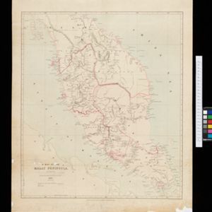
Map of the Malay Peninsula showcasing the Straits Settlements in pink, the Federated Malay States in red, and Siamese states in yellow. A table of common words in English, Malay and Siamese is included. Only four of six sheets are available.

A Map of the Malay Peninsula

event1897

location_onIndonesia, Malaysia, Singapore, Thailand

On this late 19th century map of the Malay Peninsula, the British colonial territories—the Straits Settlements of Singapore, Malacca, Dinding and Penang—are in red, demarcating them from the British protectorate states of the rest of the peninsula.

Soematra, Bangka en de Riouw-Lingga Archipel

event1897

location_onMalaysia, Indonesia, Singapore, Myanmar

Map of Sumatra and surrounding islands, with residencies—administrative districts—shown by coloured borders. There are inset maps of two residencies surrounding Padang, and of Groot-Atjeh (Aceh). Rivers, railways, roads and settlements are marked.

Map of Singapore and surrounding country

event1896

location_onSingapore, Malaysia, Indonesia

Map of Singapore Island, including the surrounding islands and straits, and southern Johor. Lighthouses are marked in red and yellow, including Horsburgh Lighthouse on Pedra Branca, Raffles Lighthouse and Fort Canning Lighthouse.

Route chart to India and the East

event1895

location_onBrunei, Cambodia, East Timor, Indonesia, Laos, Malaysia, Myanmar, Philippines, Singapore, Southeast Asia, Thailand, Vietnam

Map of Asia featuring steamship routes—including around Southeast Asia—connecting ports such as Penang, Singapore, Batavia (Jakarta), Saigon, Bangkok, Rangun (Yangon), Manila, Macassar (Makassar) etc. There is also an inset map of Singapore.

Map of the Johore Territory 1893

event1894

location_onMalaysia, Singapore

Map of the Malay state of Johor, and Singapore. The route of a proposed railway north from Johor Bahru is shown. Apart from rivers and mountains, much of the terrain is blank, with labels such as ‘Unexplored Hill Country’ or ‘Dense Jungle and Swamp’.

Trade Routes in the Far East

event1894

location_onBrunei, Cambodia, Indonesia, Laos, Malaysia, Myanmar, Philippines, Singapore, Thailand, Vietnam

Map of stream ship trade routes around Southeast Asia. Rivers, railways, submarine telegraph cables, lighthouses (fixed, revolving and flashing), graving docks and coaling stations are marked. An inset map shows a railway route from Britain to Asia.

close

  • Filter from 1630 to 1900

Current results range from 1630 to 1900