Search

Search Results

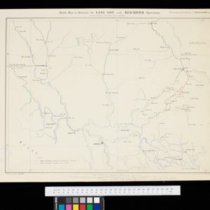
Sketch map to illustrate the Lang-son and Red River operations

event1886

location_onVietnam

Map of the French military advance on the city of Lang-Son in February 1885 during the Sino-French War, and the following month’s humiliating retreat which brought an end to the war, and triggered the collapse of the French government.

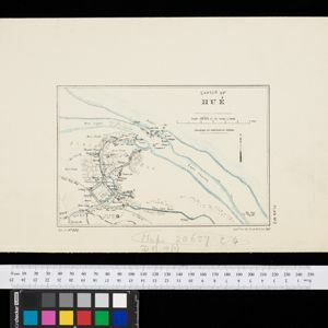
Sketch of Hué

event1885

location_onVietnam

Map of the city of Hué (Huế) on the Perfume River, east coast of Vietnam. There are forts, villages and rice fields along the river. In the city, there is the royal palace within walls and a moat, French military barracks and other colonial areas.

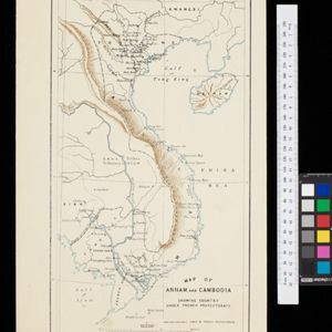
Map of Annam and Cambodia showing country under French protectorate

event1885

location_onCambodia, Laos, Thailand, Vietnam

Map showing the French protectorate territories of mainland Southeast Asia: Annam, Tongking and French Cochin China (modern Vietnam) and Cambodia. Some parts of Siam (Thailand) and Laos are also shown.

close

  • Filter from 1885 to 1886

Current results range from 1885 to 1886