Search

Search Results

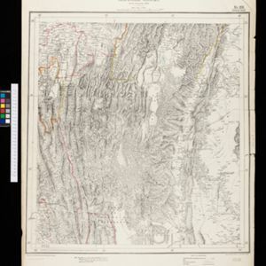
Map to accompany preliminary report on the Chin-Lushai Country

event1892

location_onMyanmar

Topographical map of the mountainous border region between India and northwest Burma (Myanmar), showing rivers, lakes, villages, towns, roads and railways. High points are marked with their heights so they can be used for triangulation.

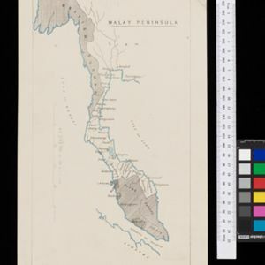
Malay Peninsula

event1886

location_onMyanmar, Thailand, Malaysia

Map of the Malay Peninsula showing three British colonial territories: British Burmah, British Malaya (Perak, Selangore, Pahang, Johore) and the Straits Settlements (Pinang/Wellesley, Dindings, Malacca (Singapore not shown)).

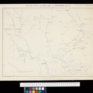
Sketch map to illustrate the Lang-son and Red River operations

event1886

location_onVietnam

Map of the French military advance on the city of Lang-Son in February 1885 during the Sino-French War, and the following month’s humiliating retreat which brought an end to the war, and triggered the collapse of the French government.

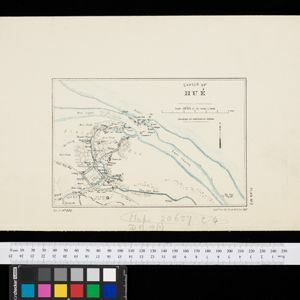
Sketch of Hué

event1885

location_onVietnam

Map of the city of Hué (Huế) on the Perfume River, east coast of Vietnam. There are forts, villages and rice fields along the river. In the city, there is the royal palace within walls and a moat, French military barracks and other colonial areas.

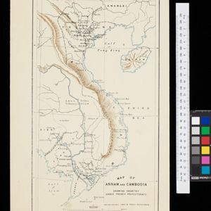
Map of Annam and Cambodia showing country under French protectorate

event1885

location_onCambodia, Laos, Thailand, Vietnam

Map showing the French protectorate territories of mainland Southeast Asia: Annam, Tongking and French Cochin China (modern Vietnam) and Cambodia. Some parts of Siam (Thailand) and Laos are also shown.

Map of the Malay Peninsula

event1883

location_onMalaysia, Singapore

The Straits Settlements are in red, with the rest of the map marked with names of local peoples (‘Inhabited by the Johor Jakuns’) and resources (mines). Many areas are left blank or vague as unexplored or approximate. Inset map of Singapore city.

Sketch of works before Phu-sa, showing position of troops at 3 p.m. on the 14th Dec 1883, before the assault

event1883

location_onVietnam

Map of Phu-Sa, a village to the northeast of the city of Sơn Tây (Vietnam), during the Tonkin campaign. It shows French troop positions (on the right, in red) before they attacked the defences of the China-backed Black Flag Army at Phu-Sa

close

  • Filter from 1883 to 1892

Current results range from 1883 to 1892