Search
Refine your results
- Filter from 1886 to 1896
Current results range from 1886 to 1896
Location
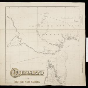
- check_box_outline_blankBritish New Guinea6
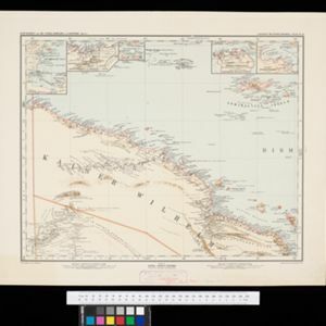
- check_box_outline_blankKaiser-Wilhelmsland4
- check_box_outline_blankNew Guinea4
- check_box_outline_blankBassac River3
- check_box_outline_blankHậu River3
- check_box_outline_blankBismarck Archipelago2
- check_box_outline_blankDutch New Guinea2
- check_box_outline_blankKaiser Wilhelms-Land2
- check_box_outline_blankPort Moresby2
- check_box_outline_blankWestern New Guinea2
- check_box_outline_blankAstrolabe Bay1
- check_box_outline_blankAstrolabe-Bucht1
- more Detailed Location »
Land Use
- check_box[remove]Kampong/Village13
- check_box_outline_blankChurch5
- check_box_outline_blankTemple3
- check_box_outline_blankCemetery/Columbarium2
- check_box_outline_blankHospital2
- check_box_outline_blankJail/Prison2
- check_box_outline_blankMissionary Building2
- check_box_outline_blankPolice Station2
- check_box_outline_blankResidential Area2
- check_box_outline_blankCourt of Law1
- check_box_outline_blankMilitary Barracks1
- check_box_outline_blankMilitary Fort1
- check_box_outline_blankPost Office1
- check_box_outline_blankPublic Space1
Land and Sea Routes
Cultural and Political Regions
Environmental Features
Insets and Attributes
Map Production Details
- check_box_outline_blankGeisendörfer, J.4
- check_box_outline_blankLassalle2
- check_box_outline_blankNguyen, Tan Hon2
- check_box_outline_blankNguyen, Van Dinh2
- check_box_outline_blankBarich, C.1
- check_box_outline_blankBrayer1
- check_box_outline_blankCarmouze1
- check_box_outline_blankCuthbertson, W.R.1
- more Map Maker »
- check_box[remove]Intelligence Division, War Office13
- check_box_outline_blankService du Cadastre de Cochinchine4
- check_box_outline_blankSurveyor General's Office, Brisbane3
- check_box_outline_blankDufrenoy2
- check_box_outline_blankLemercier et Cie.2
- check_box_outline_blankC.L. Keller1
- check_box_outline_blankJustus Perthes1
- check_box_outline_blankLanghans' Deutscher Kolonial-Atlas1
- more Printer/Publisher »

